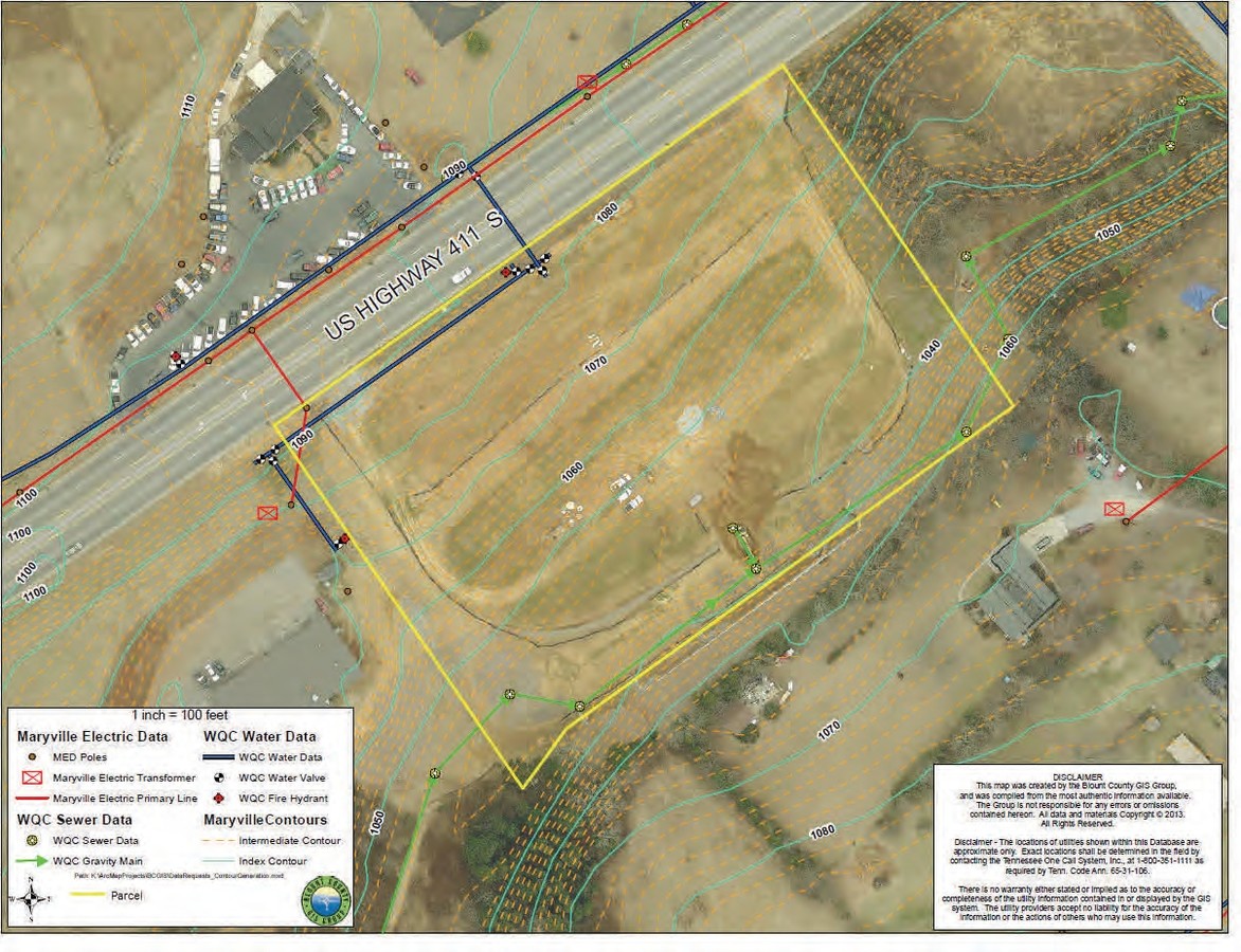
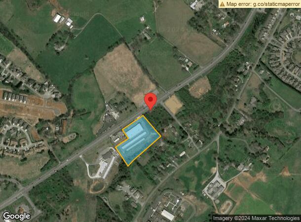
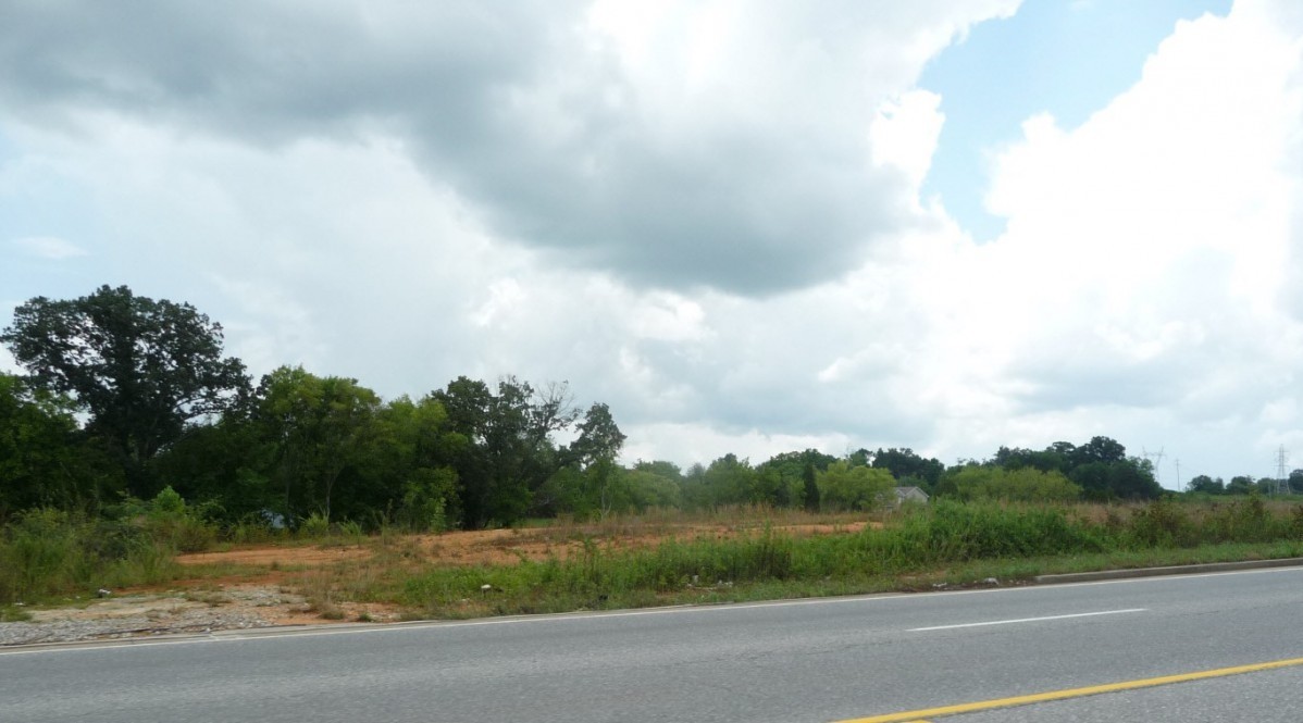
Property Record
2114 Us Highway 411 S, Maryville, TN 37801
NEARBY LISTINGS FOR SALE OR LEASE
Property Detail
2114 Us Highway 411 S
Knoxville, TN
Hitch Talley Headrick
068-042.12
HITCH TALLEY HEADRICK 6 1401A
Commercialnec
Blount
X
Tennessee
47009C0232C
6r
2023
4.18 AC
2024
Blount County
011202
Knoxville
60,720 SF
DEMOGRAPHICS near 2114 Us Highway 411 S
1 Mile
3 Mile
5 Mile
2024 Total Population
4,855
35,664
69,227
2029 Population
5,259
38,765
75,280
Pop Growth 2024-2029
+ 8.32%
+ 8.70%
+ 8.74%
Average Age
42
42
42
2024 Total Households
1,887
14,248
27,600
HH Growth 2024-2029
+ 8.43%
+ 8.79%
+ 8.81%
Median Household Inc
$66,838
$66,511
$63,003
Avg Household Size
2.50
2.40
2.40
2024 Avg HH Vehicles
2.00
2.00
2.00
Median Home Value
$270,454
$257,707
$248,583
Median Year Built
1994
1989
1988
Nearby Places
- Restaurants
- Banks
- Shops
- Fitness
- Groceries
PUBLIC TRANSPORTATION
AIRPORT
McGhee Tyson
DRIVE
WALK
Distance
McGhee Tyson
16 min
10.3 mi
Freight Ports
Georgia Ports - Savannah
DRIVE
WALK
Distance
Georgia Ports - Savannah
493 min
421.5 mi
SALE & LEASE HISTORY
LISTING DATE
SALE/LEASE

Sep 24, 2016
For Sale
Sep 18, 2017
For Sale
Jan 05, 2018
For Sale
Nearby Properties
Address
Land Use
TOTAL SIZE
Lot Size
Zoning
Address
Land Use
TOTAL SIZE
Lot Size
Zoning
325,748 SF
IND
Address
Land Use
TOTAL SIZE
Lot Size
Zoning
558,604 SF
83.49 AC
IND
Address
Land Use
TOTAL SIZE
Lot Size
Zoning
10,061 SF
22.74 AC
SPLIT
Address
Land Use
TOTAL SIZE
Lot Size
Zoning
101,640 SF
7.41 AC
SPLIT
Address
Land Use
TOTAL SIZE
Lot Size
Zoning
78,099 SF
20 AC
S
Address
Land Use
TOTAL SIZE
Lot Size
Zoning
33,912 SF
19.91 AC
HDR
Address
Land Use
TOTAL SIZE
Lot Size
Zoning
74,071 SF
5.19 AC
HIC
Address
Land Use
TOTAL SIZE
Lot Size
Zoning
77,413 SF
8.50 AC
S
Address
Land Use
TOTAL SIZE
Lot Size
Zoning
41,938 SF
7.42 AC
BT
Address
Land Use
TOTAL SIZE
Lot Size
Zoning
122,648 SF
0.10 AC
CBD
Address
Land Use
TOTAL SIZE
Lot Size
Zoning
323,040 SF
87.30 AC
IND
Address
Land Use
TOTAL SIZE
Lot Size
Zoning
55,708 SF
6.95 AC
BT
Address
Land Use
TOTAL SIZE
Lot Size
Zoning
104,327 SF
26.19 AC
CC
Address
Land Use
TOTAL SIZE
Lot Size
Zoning
106,466 SF
2.65 AC
CC
Address
Land Use
TOTAL SIZE
Lot Size
Zoning
533,928 SF
97.90 AC
IND
Address
Land Use
TOTAL SIZE
Lot Size
Zoning
15,340 SF
5 AC
Address
Land Use
TOTAL SIZE
Lot Size
Zoning
295,555 SF
IND
Address
Land Use
TOTAL SIZE
Lot Size
Zoning
60,328 SF
4.41 AC
F
Address
Land Use
TOTAL SIZE
Lot Size
Zoning
223,912 SF
25.83 AC
BT
Address
Land Use
TOTAL SIZE
Lot Size
Zoning
129,809 SF
11.37 AC
BT
Address
Land Use
TOTAL SIZE
Lot Size
Zoning
103,689 SF
5.12 AC
R
Address
Land Use
TOTAL SIZE
Lot Size
Zoning
52,162 SF
3.30 AC
R
Address
Land Use
TOTAL SIZE
Lot Size
Zoning
143,868 SF
5.50 AC
R
Address
Land Use
TOTAL SIZE
Lot Size
Zoning
42,735 SF
Address
Land Use
TOTAL SIZE
Lot Size
Zoning
45.20 AC
BT
Address
Land Use
TOTAL SIZE
Lot Size
Zoning
2,702.28 AC
R2
Address
Land Use
TOTAL SIZE
Lot Size
Zoning
66,127 SF
3.05 AC
CBDS
Address
Land Use
TOTAL SIZE
Lot Size
Zoning
570.95 AC
R2
Address
Land Use
TOTAL SIZE
Lot Size
Zoning
61,551 SF
6.53 AC
BT
Address
Land Use
TOTAL SIZE
Lot Size
Zoning
6,322 SF
15.03 AC
S
The World's #1 Commercial Real Estate Marketplace
Connect with us
© 2025 CoStar Group
The information above has been obtained from sources believed reliable. While we do not doubt its accuracy we have not verified it and make no guarantee, warranty or representation about it. It is your responsibility to independently confirm its accuracy and completeness. Any projections, opinions, assumptions, or estimates used are for example only and do not represent the current or future performance of the property. The value of this transaction to you depends on tax and other factors which should be evaluated by your tax, financial, and legal advisors. You and your advisors should conduct a careful, independent investigation of the property to determine to your satisfaction the suitability of the property for your needs.