Property Record
S Carter Rd, Smyrna, DE 19977

Property Detail
S Carter Rd
1-17-01900-01-0101-000
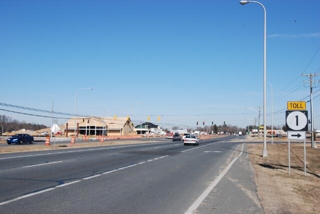
W SD US 13 2.21 A SOUTH DUPONT BOULEVARD
Residentialacreage
KENT
H-C
Delaware
B and X Area of moderate flood hazard, usually the area between the limits of the 100-year and 500-year floods.
9.70 AC
2025
Kent County
2025
Philadelphia
040205
Dover, DE
NEARBY LISTINGS FOR SALE OR LEASE
DEMOGRAPHICS near S Carter Rd
1 mile
3 mile
5 mile
2025 Total Population
7,673
30,738
41,680
2030 Population
8,147
32,321
43,801
Pop Growth 2025-2030
+ 6.18%
+ 5.15%
+ 5.09%
Average Age
40
40
41
2025 Total Households
2,959
11,023
14,729
HH Growth 2025-2030
+ 6.25%
+ 5.20%
+ 5.16%
Median Household Inc
$74,581
$89,123
$89,277
Avg Household Size
2.60
2.70
2.70
2025 Avg HH Vehicles
2.00
2.00
2.00
Median Home Value
$299,999
$349,375
$353,356
Median Year Built
2005
2003
2003
Nearby Places
Map Layers
Map Styles
 Street
 Aerial
Layers
 Traffic
 Biking
Places
Listings with unknown addresses are not visible on the map
- Restaurants
- Banks
- Shops
- Fitness
- Groceries
SALE & LEASE HISTORY
LISTING DATE
SALE/LEASE

Apr 07, 2017
For Lease
Nearby Properties
Address
Land Use
TOTAL SIZE
Lot Size
Zoning
Address
Land Use
TOTAL SIZE
Lot Size
Zoning
388,647 SF
119.70 AC
I&R
Address
Land Use
TOTAL SIZE
Lot Size
Zoning
189 AC
IORP
Address
Land Use
TOTAL SIZE
Lot Size
Zoning
1,590 SF
188.40 AC
A
Address
Land Use
TOTAL SIZE
Lot Size
Zoning
Address
Land Use
TOTAL SIZE
Lot Size
Zoning
6,760 SF
80.30 AC
MHP
Address
Land Use
TOTAL SIZE
Lot Size
Zoning
13.66 AC
28IORP
Address
Land Use
TOTAL SIZE
Lot Size
Zoning
86,973 SF
24.80 AC
R
Address
Land Use
TOTAL SIZE
Lot Size
Zoning
113,094 SF
3.44 AC
C-C
Address
Land Use
TOTAL SIZE
Lot Size
Zoning
74,160 SF
7.20 AC
R3
Address
Land Use
TOTAL SIZE
Lot Size
Zoning
40,043 SF
43.70 AC
NA
Address
Land Use
TOTAL SIZE
Lot Size
Zoning
378,374 SF
41.02 AC
I
Address
Land Use
TOTAL SIZE
Lot Size
Zoning
30,200 SF
22.42 AC
H-C
Address
Land Use
TOTAL SIZE
Lot Size
Zoning
1,440 SF
51.10 AC
RMH
Address
Land Use
TOTAL SIZE
Lot Size
Zoning
Address
Land Use
TOTAL SIZE
Lot Size
Zoning
3,816 SF
56.40 AC
RMH
Address
Land Use
TOTAL SIZE
Lot Size
Zoning
Address
Land Use
TOTAL SIZE
Lot Size
Zoning
204,214 SF
25.72 AC
BG
Address
Land Use
TOTAL SIZE
Lot Size
Zoning
57,200 SF
7.50 AC
R3
Address
Land Use
TOTAL SIZE
Lot Size
Zoning
113,479 SF
8.20 AC
R1
Address
Land Use
TOTAL SIZE
Lot Size
Zoning
Address
Land Use
TOTAL SIZE
Lot Size
Zoning
30,954 SF
23.93 AC
OR
Address
Land Use
TOTAL SIZE
Lot Size
Zoning
52,000 SF
10 AC
R3
Address
Land Use
TOTAL SIZE
Lot Size
Zoning
55,732 SF
16.30 AC
R-2A
Address
Land Use
TOTAL SIZE
Lot Size
Zoning
80,172 SF
9.50 AC
R3
Address
Land Use
TOTAL SIZE
Lot Size
Zoning
57.10 AC
I&R
Address
Land Use
TOTAL SIZE
Lot Size
Zoning
59,375 SF
13 AC
IORP
Address
Land Use
TOTAL SIZE
Lot Size
Zoning
65,280 SF
11.40 AC
H-C
Address
Land Use
TOTAL SIZE
Lot Size
Zoning
33,561 SF
35.40 AC
RS
Address
Land Use
TOTAL SIZE
Lot Size
Zoning
50,309 SF
19.90 AC
MULTI
Address
Land Use
TOTAL SIZE
Lot Size
Zoning
The World's #1 Commercial Real Estate Marketplace
Connect with us
© 2026 CoStar Group
The information above has been obtained from sources believed reliable. While we do not doubt its accuracy we have not verified it and make no guarantee, warranty or representation about it. It is your responsibility to independently confirm its accuracy and completeness. Any projections, opinions, assumptions, or estimates used are for example only and do not represent the current or future performance of the property. The value of this transaction to you depends on tax and other factors which should be evaluated by your tax, financial, and legal advisors. You and your advisors should conduct a careful, independent investigation of the property to determine to your satisfaction the suitability of the property for your needs.