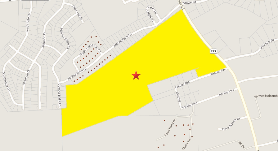
Property Record
S Point Rd, , NC

NEARBY LISTINGS FOR SALE OR LEASE
Property Detail
S Point Rd
Charlotte-Concord-Gastonia, NC-SC
The Pharr Property South Point Ridge
216910
15 067 002 00 000
University
Gaston
X
North Carolina
3710359400M
78.54 AC
0
Gaston County
2024
Charlotte
032401
DEMOGRAPHICS near S Point Rd
1 Mile
3 Mile
5 Mile
2024 Total Population
5,062
28,706
71,922
2029 Population
5,533
31,318
77,591
Pop Growth 2024-2029
+ 9.30%
+ 9.10%
+ 7.88%
Average Age
39
41
40
2024 Total Households
1,886
11,894
28,804
HH Growth 2024-2029
+ 9.49%
+ 9.27%
+ 8.02%
Median Household Inc
$98,965
$78,680
$74,808
Avg Household Size
2.70
2.40
2.40
2024 Avg HH Vehicles
2.00
2.00
2.00
Median Home Value
$297,346
$299,540
$275,567
Median Year Built
2000
1998
1994
Nearby Places
- Restaurants
- Banks
- Shops
- Fitness
- Groceries
PUBLIC TRANSPORTATION
AIRPORT
Charlotte/Douglas International
DRIVE
WALK
Distance
Charlotte/Douglas International
24 min
9.3 mi
Concord-Padgett Regional
DRIVE
WALK
Distance
Concord-Padgett Regional
39 min
27.0 mi
Freight Ports
North Charleston Terminal
DRIVE
WALK
Distance
North Charleston Terminal
237 min
205.7 mi
Nearby Properties
Address
Land Use
TOTAL SIZE
Lot Size
Zoning
Address
Land Use
TOTAL SIZE
Lot Size
Zoning
25,137 SF
34.81 AC
Address
Land Use
TOTAL SIZE
Lot Size
Zoning
142,022 SF
6.01 AC
INDS1
Address
Land Use
TOTAL SIZE
Lot Size
Zoning
30,906 SF
14.19 AC
Address
Land Use
TOTAL SIZE
Lot Size
Zoning
37.49 AC
Address
Land Use
TOTAL SIZE
Lot Size
Zoning
23,899 SF
14.57 AC
HC
Address
Land Use
TOTAL SIZE
Lot Size
Zoning
98.12 AC
Address
Land Use
TOTAL SIZE
Lot Size
Zoning
4,552 SF
9.22 AC
R1
Address
Land Use
TOTAL SIZE
Lot Size
Zoning
190,498 SF
20.10 AC
RET05
Address
Land Use
TOTAL SIZE
Lot Size
Zoning
48,452 SF
18.51 AC
PUB03
Address
Land Use
TOTAL SIZE
Lot Size
Zoning
2,000 SF
2.19 AC
Address
Land Use
TOTAL SIZE
Lot Size
Zoning
387.93 AC
R-3
Address
Land Use
TOTAL SIZE
Lot Size
Zoning
516,688 SF
36.23 AC
STOR2
Address
Land Use
TOTAL SIZE
Lot Size
Zoning
1,596 SF
5.73 AC
OFF01
Address
Land Use
TOTAL SIZE
Lot Size
Zoning
65,513 SF
3.07 AC
Address
Land Use
TOTAL SIZE
Lot Size
Zoning
139,155 SF
15.13 AC
RET05
Address
Land Use
TOTAL SIZE
Lot Size
Zoning
118,896 SF
3.98 AC
Address
Land Use
TOTAL SIZE
Lot Size
Zoning
102,915 SF
39.29 AC
PUB01
Address
Land Use
TOTAL SIZE
Lot Size
Zoning
10,172 SF
33.34 AC
PUB01
Address
Land Use
TOTAL SIZE
Lot Size
Zoning
54,030 SF
5.02 AC
OFF04
Address
Land Use
TOTAL SIZE
Lot Size
Zoning
67,682 SF
8.86 AC
Address
Land Use
TOTAL SIZE
Lot Size
Zoning
64,619 SF
15.01 AC
R5
Address
Land Use
TOTAL SIZE
Lot Size
Zoning
111,348 SF
9.81 AC
Address
Land Use
TOTAL SIZE
Lot Size
Zoning
54,304 SF
2.97 AC
MOTL1
Address
Land Use
TOTAL SIZE
Lot Size
Zoning
37,905 SF
5.47 AC
HCAR3
Address
Land Use
TOTAL SIZE
Lot Size
Zoning
1,280 SF
4.83 AC
APT01
Address
Land Use
TOTAL SIZE
Lot Size
Zoning
45,391 SF
8.23 AC
SHOP4
Address
Land Use
TOTAL SIZE
Lot Size
Zoning
27,024 SF
4.94 AC
CHUR2
Address
Land Use
TOTAL SIZE
Lot Size
Zoning
26,182 SF
2.67 AC
Address
Land Use
TOTAL SIZE
Lot Size
Zoning
12,810 SF
70.55 AC
INDS2
The World's #1 Commercial Real Estate Marketplace
Connect with us
© 2025 CoStar Group
The information above has been obtained from sources believed reliable. While we do not doubt its accuracy we have not verified it and make no guarantee, warranty or representation about it. It is your responsibility to independently confirm its accuracy and completeness. Any projections, opinions, assumptions, or estimates used are for example only and do not represent the current or future performance of the property. The value of this transaction to you depends on tax and other factors which should be evaluated by your tax, financial, and legal advisors. You and your advisors should conduct a careful, independent investigation of the property to determine to your satisfaction the suitability of the property for your needs.