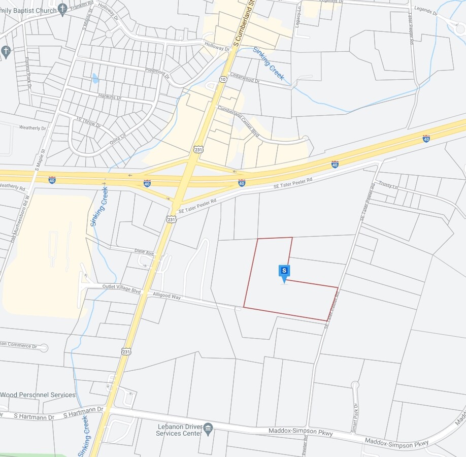
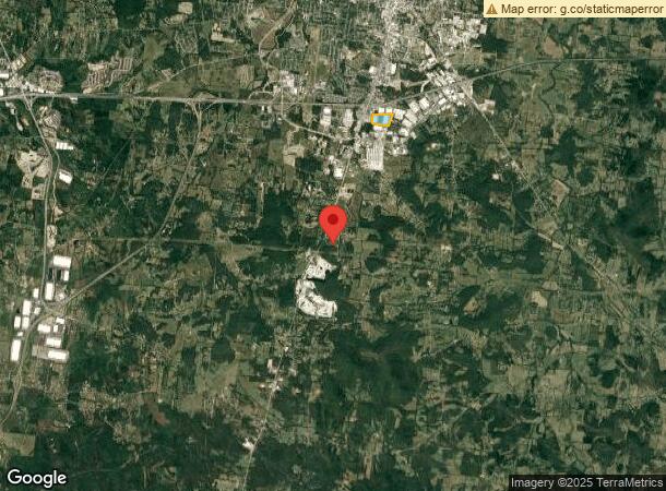
Property Record
Se Tater Peeler Rd, Lebanon, TN 37090
NEARBY LISTINGS FOR SALE OR LEASE
Property Detail
Se Tater Peeler Rd
Nashville-Davidson--Murfreesboro--Franklin, TN
Delta Express Mapco
081-077.00
DELTA EXPRESS MAPCO PB 31 PG 229
Commercialnec
Wilson
X
Tennessee
47189C0191E
p/o9
2024
38.29 AC
2024
Wilson County
030800
Nashville
412,125 SF
DEMOGRAPHICS near Se Tater Peeler Rd
1 Mile
3 Mile
5 Mile
2024 Total Population
2,035
22,371
42,982
2029 Population
2,423
26,456
50,939
Pop Growth 2024-2029
+ 19.07%
+ 18.26%
+ 18.51%
Average Age
38
39
39
2024 Total Households
815
8,558
16,466
HH Growth 2024-2029
+ 18.77%
+ 18.28%
+ 18.47%
Median Household Inc
$45,933
$48,555
$55,382
Avg Household Size
2.40
2.40
2.50
2024 Avg HH Vehicles
2.00
2.00
2.00
Median Home Value
$188,157
$245,890
$284,499
Median Year Built
1985
1985
1993
Nearby Places
- Restaurants
- Banks
- Shops
- Fitness
- Groceries
PUBLIC TRANSPORTATION
COMMUTER RAIL
Lebanon (East Corridor Line - Tennessee Regional Transportation Authority Music City Star (Music City Star))
DRIVE
WALK
Distance
Lebanon (East Corridor Line - Tennessee Regional Transportation Authority Music City Star (Music City Star))
9 min
5.0 mi
Hamilton Springs Station (WEGO STAR - WeGo Public Transit)
DRIVE
WALK
Distance
Hamilton Springs Station (WEGO STAR - WeGo Public Transit)
18 min
9.6 mi
AIRPORT
Nashville International
DRIVE
WALK
Distance
Nashville International
32 min
26.3 mi
Freight Ports
Port of Mobile
DRIVE
WALK
Distance
Port of Mobile
514 min
472.4 mi
Nearby Properties
Address
Land Use
TOTAL SIZE
Lot Size
Zoning
Address
Land Use
TOTAL SIZE
Lot Size
Zoning
395,312 SF
42.08 AC
Address
Land Use
TOTAL SIZE
Lot Size
Zoning
465,181 SF
29.13 AC
Address
Land Use
TOTAL SIZE
Lot Size
Zoning
405,286 SF
70.72 AC
Address
Land Use
TOTAL SIZE
Lot Size
Zoning
29,168 SF
304.39 AC
Address
Land Use
TOTAL SIZE
Lot Size
Zoning
530,720 SF
36.46 AC
Address
Land Use
TOTAL SIZE
Lot Size
Zoning
194,597 SF
20.20 AC
Address
Land Use
TOTAL SIZE
Lot Size
Zoning
74,767 SF
5.89 AC
B4
Address
Land Use
TOTAL SIZE
Lot Size
Zoning
383,150 SF
35.03 AC
Address
Land Use
TOTAL SIZE
Lot Size
Zoning
222,400 SF
8.71 AC
Address
Land Use
TOTAL SIZE
Lot Size
Zoning
342,800 SF
5.75 AC
M3
Address
Land Use
TOTAL SIZE
Lot Size
Zoning
104,219 SF
14.52 AC
Address
Land Use
TOTAL SIZE
Lot Size
Zoning
3,864 SF
31.30 AC
Address
Land Use
TOTAL SIZE
Lot Size
Zoning
231,867 SF
17.03 AC
M3
Address
Land Use
TOTAL SIZE
Lot Size
Zoning
46,742 SF
8.80 AC
Address
Land Use
TOTAL SIZE
Lot Size
Zoning
50,313 SF
14 AC
Address
Land Use
TOTAL SIZE
Lot Size
Zoning
59,599 SF
1.03 AC
CS
Address
Land Use
TOTAL SIZE
Lot Size
Zoning
54,892 SF
4.28 AC
B5
Address
Land Use
TOTAL SIZE
Lot Size
Zoning
52,418 SF
2.10 AC
B3
Address
Land Use
TOTAL SIZE
Lot Size
Zoning
28,061 SF
14 AC
Address
Land Use
TOTAL SIZE
Lot Size
Zoning
79,154 SF
41.53 AC
CG
Address
Land Use
TOTAL SIZE
Lot Size
Zoning
17,422 SF
14 AC
Address
Land Use
TOTAL SIZE
Lot Size
Zoning
40,892 SF
6.19 AC
B4
Address
Land Use
TOTAL SIZE
Lot Size
Zoning
47,530 SF
5.25 AC
Address
Land Use
TOTAL SIZE
Lot Size
Zoning
4,450 SF
82 AC
Address
Land Use
TOTAL SIZE
Lot Size
Zoning
26,971 SF
3.63 AC
B4
Address
Land Use
TOTAL SIZE
Lot Size
Zoning
39,747 SF
2.03 AC
Address
Land Use
TOTAL SIZE
Lot Size
Zoning
53,824 SF
2.20 AC
Address
Land Use
TOTAL SIZE
Lot Size
Zoning
952 SF
23.70 AC
AG
Address
Land Use
TOTAL SIZE
Lot Size
Zoning
97,741 SF
10.47 AC
The World's #1 Commercial Real Estate Marketplace
Connect with us
© 2025 CoStar Group
The information above has been obtained from sources believed reliable. While we do not doubt its accuracy we have not verified it and make no guarantee, warranty or representation about it. It is your responsibility to independently confirm its accuracy and completeness. Any projections, opinions, assumptions, or estimates used are for example only and do not represent the current or future performance of the property. The value of this transaction to you depends on tax and other factors which should be evaluated by your tax, financial, and legal advisors. You and your advisors should conduct a careful, independent investigation of the property to determine to your satisfaction the suitability of the property for your needs.