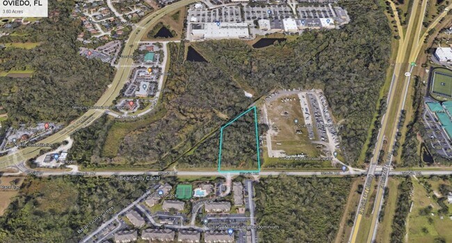
Property Record
W 426, Oviedo, FL 32765


NEARBY LISTINGS FOR SALE OR LEASE
Property Detail
W 426
Orlando-Kissimmee-Sanford, FL
Slavia Colony Companys Subdivision
20-21-31-300-0190-0000
SEC 20 TWP 21S RGE 31E NW 1/4 (LESS PT WLY OF RED BUG LAKE RD & PTS IN SLAVIA COLONY CO & TUSKA RIDGE & RD & PT IN PG 47 PG 80)
Residentialacreage
Seminole
A
Florida
12117C0190F
3.60 AC
2024
Casselberry
2024
Orlando
021314
DEMOGRAPHICS near W 426
1 Mile
3 Mile
5 Mile
2024 Total Population
4,532
69,516
201,257
2029 Population
4,722
72,048
208,048
Pop Growth 2024-2029
+ 4.19%
+ 3.64%
+ 3.37%
Average Age
41
40
38
2024 Total Households
1,589
25,829
72,668
HH Growth 2024-2029
+ 4.28%
+ 3.72%
+ 3.42%
Median Household Inc
$86,570
$88,433
$73,581
Avg Household Size
2.70
2.60
2.50
2024 Avg HH Vehicles
2.00
2.00
2.00
Median Home Value
$384,328
$371,674
$337,061
Median Year Built
1996
1991
1989
Nearby Places
Map Layers
Map Styles
 Street
 Aerial
- Restaurants
- Banks
- Shops
- Fitness
- Groceries
PUBLIC TRANSPORTATION
COMMUTER RAIL
DRIVE
WALK
Distance
14 min
7.6 mi
DRIVE
WALK
Distance
16 min
8.9 mi
AIRPORT
Orlando Sanford International
DRIVE
WALK
Distance
Orlando Sanford International
19 min
12.3 mi
Orlando International
DRIVE
WALK
Distance
Orlando International
30 min
23.4 mi
SALE & LEASE HISTORY
LISTING DATE
SALE/LEASE

Sep 20, 2023
For Sale
Nearby Properties
Address
Land Use
TOTAL SIZE
Lot Size
Zoning
Address
Land Use
TOTAL SIZE
Lot Size
Zoning
7,384 SF
16.66 AC
Address
Land Use
TOTAL SIZE
Lot Size
Zoning
15.52 AC
Address
Land Use
TOTAL SIZE
Lot Size
Zoning
276,300 SF
3.34 AC
A1
Address
Land Use
TOTAL SIZE
Lot Size
Zoning
5,938 SF
9.14 AC
Address
Land Use
TOTAL SIZE
Lot Size
Zoning
1,386 SF
19.84 AC
PUD
Address
Land Use
TOTAL SIZE
Lot Size
Zoning
432 SF
16.07 AC
PUD
Address
Land Use
TOTAL SIZE
Lot Size
Zoning
792 SF
15.23 AC
PUD
Address
Land Use
TOTAL SIZE
Lot Size
Zoning
6,321 SF
40.84 AC
Address
Land Use
TOTAL SIZE
Lot Size
Zoning
183,886 SF
47.67 AC
A1
Address
Land Use
TOTAL SIZE
Lot Size
Zoning
98,868 SF
3.03 AC
Address
Land Use
TOTAL SIZE
Lot Size
Zoning
415,744 SF
25.54 AC
PUD
Address
Land Use
TOTAL SIZE
Lot Size
Zoning
25,480 SF
23.86 AC
PUD
Address
Land Use
TOTAL SIZE
Lot Size
Zoning
4,380 SF
20 AC
A1
Address
Land Use
TOTAL SIZE
Lot Size
Zoning
3,406 SF
29.43 AC
PUD
Address
Land Use
TOTAL SIZE
Lot Size
Zoning
186,284 SF
16.28 AC
R3
Address
Land Use
TOTAL SIZE
Lot Size
Zoning
24,775 SF
15.86 AC
PUD
Address
Land Use
TOTAL SIZE
Lot Size
Zoning
203,683 SF
8.82 AC
R4
Address
Land Use
TOTAL SIZE
Lot Size
Zoning
193,990 SF
27.51 AC
C2
Address
Land Use
TOTAL SIZE
Lot Size
Zoning
144,594 SF
19.94 AC
R3A
Address
Land Use
TOTAL SIZE
Lot Size
Zoning
280,330 SF
14.77 AC
MUDNDD
Address
Land Use
TOTAL SIZE
Lot Size
Zoning
10,640 SF
9.46 AC
C1
Address
Land Use
TOTAL SIZE
Lot Size
Zoning
10,500 SF
21.76 AC
PUD
Address
Land Use
TOTAL SIZE
Lot Size
Zoning
165,650 SF
11.12 AC
M1A
Address
Land Use
TOTAL SIZE
Lot Size
Zoning
88,181 SF
9.62 AC
C1
Address
Land Use
TOTAL SIZE
Lot Size
Zoning
193,241 SF
25.77 AC
R3A
Address
Land Use
TOTAL SIZE
Lot Size
Zoning
8,932 SF
8.75 AC
C1
Address
Land Use
TOTAL SIZE
Lot Size
Zoning
100,483 SF
4.99 AC
M1A
Address
Land Use
TOTAL SIZE
Lot Size
Zoning
216,541 SF
1.19 AC
PUD
Address
Land Use
TOTAL SIZE
Lot Size
Zoning
121,389 SF
30.79 AC
A1
Address
Land Use
TOTAL SIZE
Lot Size
Zoning
77,228 SF
3.52 AC
PUD
The World's #1 Commercial Real Estate Marketplace
Connect with us
© 2025 CoStar Group
The information above has been obtained from sources believed reliable. While we do not doubt its accuracy we have not verified it and make no guarantee, warranty or representation about it. It is your responsibility to independently confirm its accuracy and completeness. Any projections, opinions, assumptions, or estimates used are for example only and do not represent the current or future performance of the property. The value of this transaction to you depends on tax and other factors which should be evaluated by your tax, financial, and legal advisors. You and your advisors should conduct a careful, independent investigation of the property to determine to your satisfaction the suitability of the property for your needs.