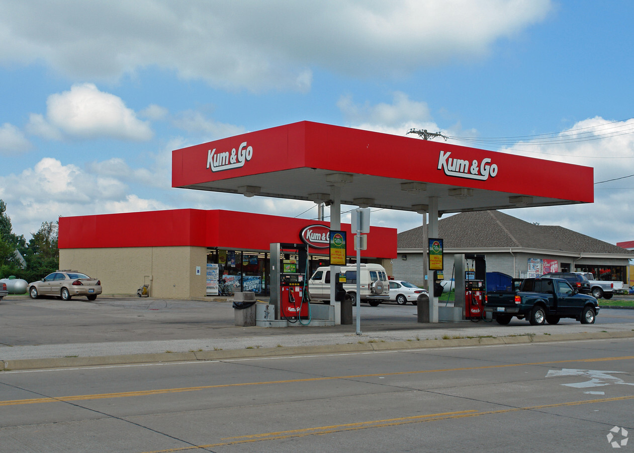
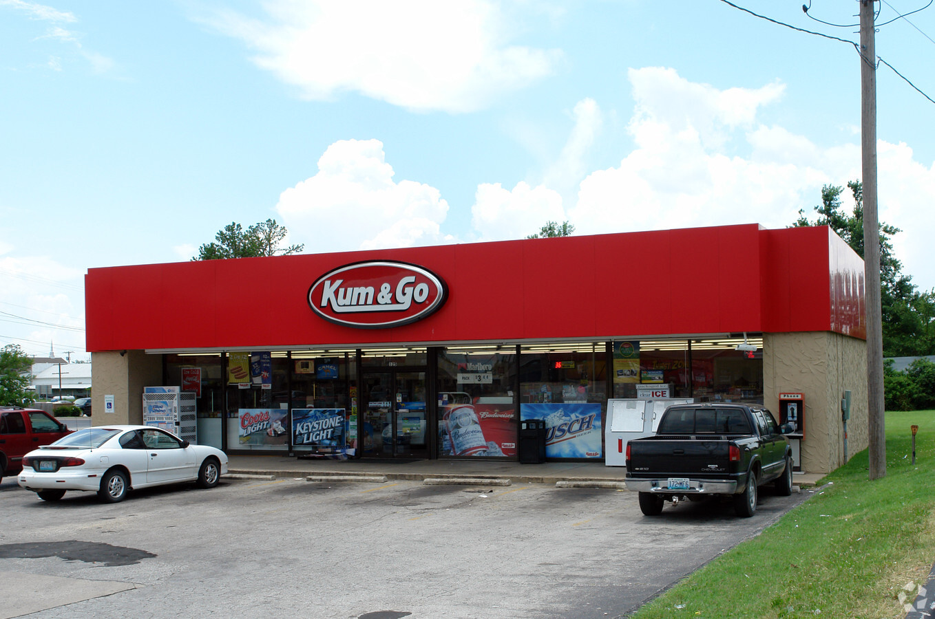
Property Record
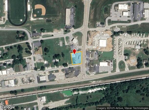
125 S State Highway 125, Strafford, MO 65757
NEARBY LISTINGS FOR SALE OR LEASE
Property Detail
125 S State Highway 125
Springfield, MO
Strafford Orig Plat
11-03-205-014
STRAFFORD BEG 50 FT E NE COR LOT 16 BLK 1 E 141.7 FT SLY TO PINE ST W 114 FT NTO BEG
Storebuilding
Greene
X
Missouri
29077C0263E
16
2024
0.45 AC
2024
Outlying Greene County
004601
Springfield
2,400 SF
DEMOGRAPHICS near 125 S State Highway 125
1 Mile
3 Mile
5 Mile
2024 Total Population
2,413
4,150
7,907
2029 Population
2,490
4,285
8,182
Pop Growth 2024-2029
+ 3.19%
+ 3.25%
+ 3.48%
Average Age
39
40
41
2024 Total Households
898
1,566
3,056
HH Growth 2024-2029
+ 3.34%
+ 3.45%
+ 3.63%
Median Household Inc
$61,389
$65,022
$69,977
Avg Household Size
2.60
2.60
2.50
2024 Avg HH Vehicles
2.00
2.00
2.00
Median Home Value
$195,660
$217,515
$254,887
Median Year Built
1987
1986
1987
Nearby Places
- Restaurants
- Banks
- Shops
- Fitness
- Groceries
PUBLIC TRANSPORTATION
AIRPORT
Springfield-Branson Ntl
DRIVE
WALK
Distance
Springfield-Branson Ntl
29 min
19.8 mi
Freight Ports
Tulsa Port of Inola
DRIVE
WALK
Distance
Tulsa Port of Inola
202 min
182.2 mi
Nearby Properties
Address
Land Use
TOTAL SIZE
Lot Size
Zoning
Address
Land Use
TOTAL SIZE
Lot Size
Zoning
39.60 AC
INC
Address
Land Use
TOTAL SIZE
Lot Size
Zoning
9.17 AC
INC.
Address
Land Use
TOTAL SIZE
Lot Size
Zoning
10.11 AC
INC
Address
Land Use
TOTAL SIZE
Lot Size
Zoning
1,500 SF
27.47 AC
Address
Land Use
TOTAL SIZE
Lot Size
Zoning
17.48 AC
INC
Address
Land Use
TOTAL SIZE
Lot Size
Zoning
10.07 AC
INC.
Address
Land Use
TOTAL SIZE
Lot Size
Zoning
17.36 AC
INC.
Address
Land Use
TOTAL SIZE
Lot Size
Zoning
12.03 AC
INC
Address
Land Use
TOTAL SIZE
Lot Size
Zoning
61,640 SF
34.65 AC
INC
Address
Land Use
TOTAL SIZE
Lot Size
Zoning
23,806 SF
42.74 AC
INC
Address
Land Use
TOTAL SIZE
Lot Size
Zoning
2.97 AC
INC
Address
Land Use
TOTAL SIZE
Lot Size
Zoning
31,101 SF
12 AC
INC
Address
Land Use
TOTAL SIZE
Lot Size
Zoning
6.93 AC
INC
Address
Land Use
TOTAL SIZE
Lot Size
Zoning
2.79 AC
INC
Address
Land Use
TOTAL SIZE
Lot Size
Zoning
8.98 AC
INC
Address
Land Use
TOTAL SIZE
Lot Size
Zoning
1,364 SF
14.79 AC
INC
Address
Land Use
TOTAL SIZE
Lot Size
Zoning
Address
Land Use
TOTAL SIZE
Lot Size
Zoning
2.06 AC
INC.
Address
Land Use
TOTAL SIZE
Lot Size
Zoning
14,080 SF
10.71 AC
Address
Land Use
TOTAL SIZE
Lot Size
Zoning
22,450 SF
31.65 AC
INC
Address
Land Use
TOTAL SIZE
Lot Size
Zoning
23,636 SF
10.20 AC
INC
Address
Land Use
TOTAL SIZE
Lot Size
Zoning
16.22 AC
Address
Land Use
TOTAL SIZE
Lot Size
Zoning
8,146 SF
2.32 AC
INC
Address
Land Use
TOTAL SIZE
Lot Size
Zoning
14,556 SF
4.71 AC
Address
Land Use
TOTAL SIZE
Lot Size
Zoning
4,253 SF
26.40 AC
INC
Address
Land Use
TOTAL SIZE
Lot Size
Zoning
5,643 SF
3.49 AC
INC
Address
Land Use
TOTAL SIZE
Lot Size
Zoning
5,519 SF
2.85 AC
INC
Address
Land Use
TOTAL SIZE
Lot Size
Zoning
23,660 SF
5.98 AC
INC
Address
Land Use
TOTAL SIZE
Lot Size
Zoning
1.55 AC
INC
Address
Land Use
TOTAL SIZE
Lot Size
Zoning
12.35 AC
INC
The World's #1 Commercial Real Estate Marketplace
Connect with us
© 2025 CoStar Group
The information above has been obtained from sources believed reliable. While we do not doubt its accuracy we have not verified it and make no guarantee, warranty or representation about it. It is your responsibility to independently confirm its accuracy and completeness. Any projections, opinions, assumptions, or estimates used are for example only and do not represent the current or future performance of the property. The value of this transaction to you depends on tax and other factors which should be evaluated by your tax, financial, and legal advisors. You and your advisors should conduct a careful, independent investigation of the property to determine to your satisfaction the suitability of the property for your needs.