Property Record
18896 Telegraph Rd, Romulus, MI 48174
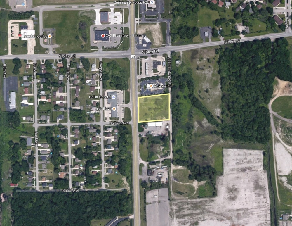

This Property Is For Sale
NEARBY LISTINGS FOR SALE OR LEASE
Property Detail
18896 Telegraph Rd
Detroit-Warren-Dearborn, MI
Michael's Sub
70-014-99-0012-708
05 T4S PART OF THE SE 1/4 OF SEC 5, T4S, R10E DESC AS COMM AT THE SE COR OF SEC 5 TH N 89D 45M 24S W 430 FT AND N 00D 40M 54S E 60 FT FOR THE POB; TH N 89D 45M 24S W 113.58 FT; TH N 00D 58M 00S E 375.67 FT; TH S 89D 45M 24S E 441.41 FT TH S 00D 40M 5
Wholesaleoutletdiscountstore
Wayne
X
Michigan
26163C0392E
0012
2023
2.07 AC
2024
Downriver South
591600
Detroit
8,364 SF
DEMOGRAPHICS near 18896 Telegraph Rd
1 Mile
3 Mile
5 Mile
2024 Total Population
4,551
45,961
134,943
2029 Population
4,424
44,093
129,508
Pop Growth 2024-2029
(2.79%)
(4.06%)
(4.03%)
Average Age
38
41
42
2024 Total Households
1,835
18,510
56,227
HH Growth 2024-2029
(2.83%)
(4.05%)
(4.05%)
Median Household Inc
$54,571
$61,928
$66,635
Avg Household Size
2.50
2.40
2.30
2024 Avg HH Vehicles
2.00
2.00
2.00
Median Home Value
$178,852
$201,774
$180,906
Median Year Built
1990
1979
1972
Nearby Places
- Restaurants
- Banks
- Shops
- Fitness
- Groceries
PUBLIC TRANSPORTATION
AIRPORT
Detroit Metro Wayne County
Drive
Walk
Distance
Detroit Metro Wayne County
14 min
8.7 mi
Windsor International
Drive
Walk
Distance
Windsor International
43 min
26.7 mi
Freight Ports
Port of Toledo
Drive
Walk
Distance
Port of Toledo
58 min
45.4 mi
Nearby Properties
Address
Land Use
TOTAL SIZE
Lot Size
Zoning
Address
Land Use
TOTAL SIZE
Lot Size
Zoning
553004
61.46 AC
B-2
Address
Land Use
TOTAL SIZE
Lot Size
Zoning
3122068
260 AC
I-1
Address
Land Use
TOTAL SIZE
Lot Size
Zoning
20191
166.35 AC
I-2
Address
Land Use
TOTAL SIZE
Lot Size
Zoning
495000
126.47 AC
I-2
Address
Land Use
TOTAL SIZE
Lot Size
Zoning
182.23 AC
Address
Land Use
TOTAL SIZE
Lot Size
Zoning
217726
27.60 AC
B-2
Address
Land Use
TOTAL SIZE
Lot Size
Zoning
11.88 AC
PUD
Address
Land Use
TOTAL SIZE
Lot Size
Zoning
89496
12.82 AC
B-2
Address
Land Use
TOTAL SIZE
Lot Size
Zoning
13.95 AC
Address
Land Use
TOTAL SIZE
Lot Size
Zoning
729040
45.85 AC
I-2
Address
Land Use
TOTAL SIZE
Lot Size
Zoning
218586
21.39 AC
I-1
Address
Land Use
TOTAL SIZE
Lot Size
Zoning
200484
48.86 AC
B-3
Address
Land Use
TOTAL SIZE
Lot Size
Zoning
35.50 AC
RM-1
Address
Land Use
TOTAL SIZE
Lot Size
Zoning
21.10 AC
TC
Address
Land Use
TOTAL SIZE
Lot Size
Zoning
236908
29.21 AC
B2
Address
Land Use
TOTAL SIZE
Lot Size
Zoning
172998
17.91 AC
RM-1
Address
Land Use
TOTAL SIZE
Lot Size
Zoning
42.98 AC
Address
Land Use
TOTAL SIZE
Lot Size
Zoning
11686
40 AC
Address
Land Use
TOTAL SIZE
Lot Size
Zoning
203456
21.80 AC
Address
Land Use
TOTAL SIZE
Lot Size
Zoning
203114
14.50 AC
R-M MUL
Address
Land Use
TOTAL SIZE
Lot Size
Zoning
144724
12.13 AC
B-2
Address
Land Use
TOTAL SIZE
Lot Size
Zoning
69651
15 AC
B-3
Address
Land Use
TOTAL SIZE
Lot Size
Zoning
4860
69.40 AC
MHP MOB
Address
Land Use
TOTAL SIZE
Lot Size
Zoning
15.06 AC
RM-1
Address
Land Use
TOTAL SIZE
Lot Size
Zoning
125828
8.17 AC
B-2 COM
Address
Land Use
TOTAL SIZE
Lot Size
Zoning
148815
9.11 AC
RM MULTI F
Address
Land Use
TOTAL SIZE
Lot Size
Zoning
71253
5.04 AC
RM-2
Address
Land Use
TOTAL SIZE
Lot Size
Zoning
237058
2.82 AC
B-2
Address
Land Use
TOTAL SIZE
Lot Size
Zoning
167004
19.04 AC
RM-1
Address
Land Use
TOTAL SIZE
Lot Size
Zoning
207055
2.84 AC
B-2
Start a new search to find other properties for sale or lease
Connect with us
© 2024 CoStar Group
The information above has been obtained from sources believed reliable. While we do not doubt its accuracy we have not verified it and make no guarantee, warranty or representation about it. It is your responsibility to independently confirm its accuracy and completeness. Any projections, opinions, assumptions, or estimates used are for example only and do not represent the current or future performance of the property. The value of this transaction to you depends on tax and other factors which should be evaluated by your tax, financial, and legal advisors. You and your advisors should conduct a careful, independent investigation of the property to determine to your satisfaction the suitability of the property for your needs.