Property Record
Us Highway 74 St W, Peachland, NC 28133

NEARBY LISTINGS FOR SALE OR LEASE
-
-
View all Peachland listings for sale on LoopNet.com
Property Detail
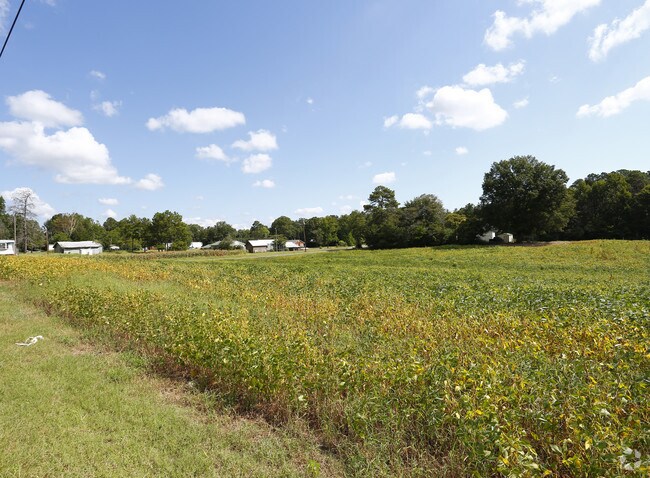
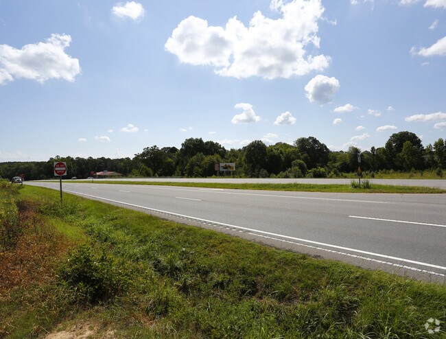
Us Highway 74 St W
6425-13-13-6999-00
8PP 642513137978&6425132400901305/126
Vacantlandnec
Anson
X
North Carolina
3710642500J
6999
2024
3.74 AC
2024
Anson County
920301
Charlotte
DEMOGRAPHICS near Us Highway 74 St W
1 Mile
3 Mile
5 Mile
2024 Total Population
523
1,497
5,618
2029 Population
525
1,518
5,715
Pop Growth 2024-2029
+ 0.38%
+ 1.40%
+ 1.73%
Average Age
44
44
42
2024 Total Households
221
630
1,683
HH Growth 2024-2029
+ 0.45%
+ 1.27%
+ 2.38%
Median Household Inc
$53,200
$54,225
$55,167
Avg Household Size
2.40
2.40
2.40
2024 Avg HH Vehicles
2.00
2.00
2.00
Median Home Value
$199,999
$205,034
$195,394
Median Year Built
1969
1971
1976
Nearby Places
Map Layers
Map Styles
 Street
 Aerial
- Restaurants
- Banks
- Shops
- Fitness
- Groceries
SALE & LEASE HISTORY
LISTING DATE
SALE/LEASE

Oct 17, 2018
For Sale
Nearby Properties
Address
Land Use
TOTAL SIZE
Lot Size
Zoning
Address
Land Use
TOTAL SIZE
Lot Size
Zoning
85,410 SF
59.07 AC
Address
Land Use
TOTAL SIZE
Lot Size
Zoning
60,979 SF
27.21 AC
Address
Land Use
TOTAL SIZE
Lot Size
Zoning
12,740 SF
1.59 AC
Address
Land Use
TOTAL SIZE
Lot Size
Zoning
105,157 SF
146.50 AC
Address
Land Use
TOTAL SIZE
Lot Size
Zoning
9,114 SF
4.43 AC
Address
Land Use
TOTAL SIZE
Lot Size
Zoning
8,125 SF
76.40 AC
RA-20 UNIO
Address
Land Use
TOTAL SIZE
Lot Size
Zoning
16,800 SF
5.15 AC
Address
Land Use
TOTAL SIZE
Lot Size
Zoning
14,188 SF
3 AC
Address
Land Use
TOTAL SIZE
Lot Size
Zoning
44.47 AC
Address
Land Use
TOTAL SIZE
Lot Size
Zoning
234.15 AC
Address
Land Use
TOTAL SIZE
Lot Size
Zoning
8,460 SF
1.72 AC
Address
Land Use
TOTAL SIZE
Lot Size
Zoning
10,000 SF
39.96 AC
RA-20 UNIO
Address
Land Use
TOTAL SIZE
Lot Size
Zoning
22.68 AC
Address
Land Use
TOTAL SIZE
Lot Size
Zoning
8,636 SF
1.86 AC
Address
Land Use
TOTAL SIZE
Lot Size
Zoning
10,560 SF
1.70 AC
Address
Land Use
TOTAL SIZE
Lot Size
Zoning
0.12 AC
Address
Land Use
TOTAL SIZE
Lot Size
Zoning
9,320 SF
9,403 AC
Address
Land Use
TOTAL SIZE
Lot Size
Zoning
2,460 SF
57.21 AC
Address
Land Use
TOTAL SIZE
Lot Size
Zoning
1.07 AC
RA-40 UNIO
Address
Land Use
TOTAL SIZE
Lot Size
Zoning
14,084 SF
8.42 AC
Address
Land Use
TOTAL SIZE
Lot Size
Zoning
2,088 SF
7.50 AC
Address
Land Use
TOTAL SIZE
Lot Size
Zoning
25.62 AC
RA-40 UNIO
Address
Land Use
TOTAL SIZE
Lot Size
Zoning
46,000 SF
4.67 AC
Address
Land Use
TOTAL SIZE
Lot Size
Zoning
4,299 SF
8.10 AC
Address
Land Use
TOTAL SIZE
Lot Size
Zoning
3,446 SF
8.23 AC
Address
Land Use
TOTAL SIZE
Lot Size
Zoning
0.24 AC
Address
Land Use
TOTAL SIZE
Lot Size
Zoning
4,894 SF
2.45 AC
HC UNION C
Address
Land Use
TOTAL SIZE
Lot Size
Zoning
14,400 SF
5.79 AC
Address
Land Use
TOTAL SIZE
Lot Size
Zoning
4,592 SF
2.25 AC
The World's #1 Commercial Real Estate Marketplace
Connect with us
© 2026 CoStar Group
The information above has been obtained from sources believed reliable. While we do not doubt its accuracy we have not verified it and make no guarantee, warranty or representation about it. It is your responsibility to independently confirm its accuracy and completeness. Any projections, opinions, assumptions, or estimates used are for example only and do not represent the current or future performance of the property. The value of this transaction to you depends on tax and other factors which should be evaluated by your tax, financial, and legal advisors. You and your advisors should conduct a careful, independent investigation of the property to determine to your satisfaction the suitability of the property for your needs.