Property Record
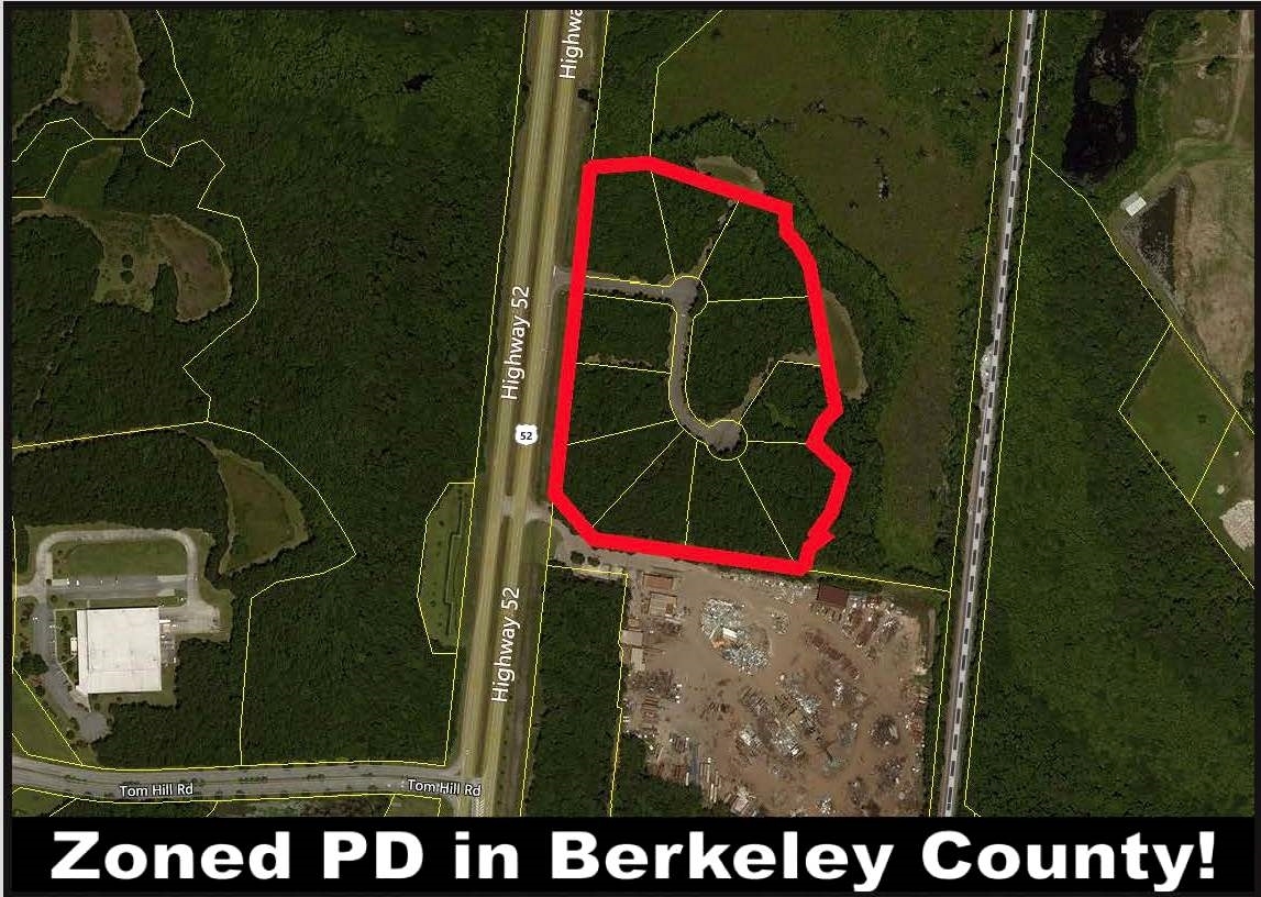
3100 Highway 52, Moncks Corner, SC 29461
NEARBY LISTINGS FOR SALE OR LEASE
Property Detail
3100 Highway 52
Charleston-North Charleston, SC
Commerical Old 52 / New 52
224-00-01-001
NEW TR A
Vacantlandnec
Berkeley
X
South Carolina
45015C0585E
41.08 AC
2024
Outlying Berkeley County
2023
Charleston/N Charleston
020707
DEMOGRAPHICS near 3100 Highway 52
1 Mile
3 Mile
5 Mile
2024 Total Population
2,418
17,579
71,479
2029 Population
2,847
20,712
84,095
Pop Growth 2024-2029
+ 17.74%
+ 17.82%
+ 17.65%
Average Age
33
35
37
2024 Total Households
813
6,052
26,314
HH Growth 2024-2029
+ 17.84%
+ 17.86%
+ 17.73%
Median Household Inc
$83,823
$88,624
$79,331
Avg Household Size
2.90
2.90
2.70
2024 Avg HH Vehicles
2.00
2.00
2.00
Median Home Value
$278,891
$274,594
$250,515
Median Year Built
2011
2010
2001
Nearby Places
- Restaurants
- Banks
- Shops
- Fitness
- Groceries
PUBLIC TRANSPORTATION
AIRPORT
Charleston AFB/International
DRIVE
WALK
Distance
Charleston AFB/International
26 min
15.9 mi
Freight Ports
North Charleston Terminal
DRIVE
WALK
Distance
North Charleston Terminal
19 min
14.2 mi
SALE & LEASE HISTORY
LISTING DATE
SALE/LEASE

Sep 24, 2016
For Sale
Apr 06, 2017
For Sale
Nearby Properties
Address
Land Use
TOTAL SIZE
Lot Size
Zoning
Address
Land Use
TOTAL SIZE
Lot Size
Zoning
236,940 SF
27.43 AC
BERKELEY C
Address
Land Use
TOTAL SIZE
Lot Size
Zoning
113,661 SF
21.93 AC
BERKELEY C
Address
Land Use
TOTAL SIZE
Lot Size
Zoning
173.54 AC
BERKELEY C
Address
Land Use
TOTAL SIZE
Lot Size
Zoning
171,630 SF
19.30 AC
GOOSE CREE
Address
Land Use
TOTAL SIZE
Lot Size
Zoning
151.18 AC
BERKELEY C
Address
Land Use
TOTAL SIZE
Lot Size
Zoning
201,500 SF
30.94 AC
BERKELEY C
Address
Land Use
TOTAL SIZE
Lot Size
Zoning
6,500 SF
10 AC
GOOSE CREE
Address
Land Use
TOTAL SIZE
Lot Size
Zoning
83,500 SF
6 AC
BERKELEY C
Address
Land Use
TOTAL SIZE
Lot Size
Zoning
100,440 SF
15 AC
BERKELEY C
Address
Land Use
TOTAL SIZE
Lot Size
Zoning
153,200 SF
47.96 AC
BERKELEY C
Address
Land Use
TOTAL SIZE
Lot Size
Zoning
90,720 SF
2 AC
GOOSE CREE
Address
Land Use
TOTAL SIZE
Lot Size
Zoning
2,464.94 AC
BERKELEY C
Address
Land Use
TOTAL SIZE
Lot Size
Zoning
18,200 SF
6 AC
MONCKS COR
Address
Land Use
TOTAL SIZE
Lot Size
Zoning
40.32 AC
BERKELEY C
Address
Land Use
TOTAL SIZE
Lot Size
Zoning
85,325 SF
28.95 AC
BERKELEY C
Address
Land Use
TOTAL SIZE
Lot Size
Zoning
35.23 AC
BERKELEY C
Address
Land Use
TOTAL SIZE
Lot Size
Zoning
32.84 AC
BERKELEY C
Address
Land Use
TOTAL SIZE
Lot Size
Zoning
13,452 SF
1.66 AC
BERKELEY C
Address
Land Use
TOTAL SIZE
Lot Size
Zoning
45,081 SF
6.97 AC
MONCKS COR
Address
Land Use
TOTAL SIZE
Lot Size
Zoning
12.77 AC
GOOSE CREE
Address
Land Use
TOTAL SIZE
Lot Size
Zoning
70,000 SF
7.13 AC
BERKELEY C
Address
Land Use
TOTAL SIZE
Lot Size
Zoning
387.64 AC
BERKELEY C
Address
Land Use
TOTAL SIZE
Lot Size
Zoning
512 SF
6.05 AC
Address
Land Use
TOTAL SIZE
Lot Size
Zoning
13,346 SF
17.03 AC
MONCKS COR
Address
Land Use
TOTAL SIZE
Lot Size
Zoning
103,000 SF
16.07 AC
BERKELEY C
Address
Land Use
TOTAL SIZE
Lot Size
Zoning
4,992 SF
1.53 AC
MONCKS COR
Address
Land Use
TOTAL SIZE
Lot Size
Zoning
515.44 AC
GOOSE CREE
Address
Land Use
TOTAL SIZE
Lot Size
Zoning
6,251 SF
2.88 AC
MONCKS COR
Address
Land Use
TOTAL SIZE
Lot Size
Zoning
57,169 SF
6.56 AC
BERKELEY C
Address
Land Use
TOTAL SIZE
Lot Size
Zoning
12,180 SF
5.07 AC
MONCKS COR
The World's #1 Commercial Real Estate Marketplace
Connect with us
© 2025 CoStar Group
The information above has been obtained from sources believed reliable. While we do not doubt its accuracy we have not verified it and make no guarantee, warranty or representation about it. It is your responsibility to independently confirm its accuracy and completeness. Any projections, opinions, assumptions, or estimates used are for example only and do not represent the current or future performance of the property. The value of this transaction to you depends on tax and other factors which should be evaluated by your tax, financial, and legal advisors. You and your advisors should conduct a careful, independent investigation of the property to determine to your satisfaction the suitability of the property for your needs.