Property Record
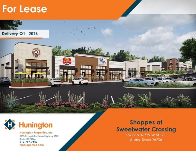
W State Hy 71, Austin, TX 78738

Property Detail
W State Hy 71
Austin-Round Rock-San Marcos, TX
LOT 5 BLK C SWEETWATER CROSSING PHS 1
900111
TRAVIS
Vacantlandnec
Texas
B and X Area of moderate flood hazard, usually the area between the limits of the 100-year and 500-year floods.
5
2023
9.02 AC
2023
Southwest
001773
Austin
NEARBY LISTINGS FOR SALE OR LEASE
DEMOGRAPHICS near W State Hy 71
1 mile
3 mile
5 mile
2025 Total Population
3,916
25,679
53,111
2030 Population
4,214
27,324
56,408
Pop Growth 2025-2030
+ 7.61%
+ 6.41%
+ 6.21%
Average Age
40
42
43
2025 Total Households
1,359
9,416
20,184
HH Growth 2025-2030
+ 8.09%
+ 6.75%
+ 6.74%
Median Household Inc
$173,233
$181,865
$168,364
Avg Household Size
2.90
2.70
2.60
2025 Avg HH Vehicles
2.00
2.00
2.00
Median Home Value
$854,623
$861,892
$826,688
Median Year Built
2011
2010
2010
Nearby Places
Map Layers
Map Styles
 Street
 Aerial
Transit
 Traffic
 Biking
Places
Listings with unknown addresses are not visible on the map
- Restaurants
- Banks
- Shops
- Fitness
- Groceries
PUBLIC TRANSPORTATION
AIRPORT
Austin-Bergstrom International
Drive
Walk
Distance
Austin-Bergstrom International
43 min
26.6 mi
Freight Ports
Calhoun Port
Drive
Walk
Distance
Calhoun Port
208 min
170.0 mi
Nearby Properties
Address
Land Use
TOTAL SIZE
Lot Size
Zoning
Address
Land Use
TOTAL SIZE
Lot Size
Zoning
826,410 SF
154.43 AC
Address
Land Use
TOTAL SIZE
Lot Size
Zoning
270,509 SF
8.84 AC
Address
Land Use
TOTAL SIZE
Lot Size
Zoning
375,383 SF
34.13 AC
Address
Land Use
TOTAL SIZE
Lot Size
Zoning
332,908 SF
16.88 AC
Address
Land Use
TOTAL SIZE
Lot Size
Zoning
267,540 SF
17.53 AC
Address
Land Use
TOTAL SIZE
Lot Size
Zoning
8,711 SF
16.94 AC
Address
Land Use
TOTAL SIZE
Lot Size
Zoning
116,867 SF
13.94 AC
Address
Land Use
TOTAL SIZE
Lot Size
Zoning
668.19 AC
Address
Land Use
TOTAL SIZE
Lot Size
Zoning
131,175 SF
36.46 AC
Address
Land Use
TOTAL SIZE
Lot Size
Zoning
150,000 SF
13.52 AC
Address
Land Use
TOTAL SIZE
Lot Size
Zoning
121.82 AC
Address
Land Use
TOTAL SIZE
Lot Size
Zoning
110,000 SF
8.37 AC
Address
Land Use
TOTAL SIZE
Lot Size
Zoning
55,468 SF
Address
Land Use
TOTAL SIZE
Lot Size
Zoning
104,303 SF
15.45 AC
Address
Land Use
TOTAL SIZE
Lot Size
Zoning
4,500 SF
70 AC
Address
Land Use
TOTAL SIZE
Lot Size
Zoning
90,648 SF
8.60 AC
Address
Land Use
TOTAL SIZE
Lot Size
Zoning
84,916 SF
17.89 AC
Address
Land Use
TOTAL SIZE
Lot Size
Zoning
173,250 SF
5.72 AC
Address
Land Use
TOTAL SIZE
Lot Size
Zoning
333.32 AC
Address
Land Use
TOTAL SIZE
Lot Size
Zoning
101,017 SF
10.62 AC
Address
Land Use
TOTAL SIZE
Lot Size
Zoning
42,000 SF
2.01 AC
Address
Land Use
TOTAL SIZE
Lot Size
Zoning
34,269 SF
5.64 AC
Address
Land Use
TOTAL SIZE
Lot Size
Zoning
92,512 SF
4 AC
Address
Land Use
TOTAL SIZE
Lot Size
Zoning
74,864 SF
6.41 AC
Address
Land Use
TOTAL SIZE
Lot Size
Zoning
50,975 SF
7.33 AC
Address
Land Use
TOTAL SIZE
Lot Size
Zoning
102,608 SF
5.88 AC
Address
Land Use
TOTAL SIZE
Lot Size
Zoning
99,700 SF
4.40 AC
Address
Land Use
TOTAL SIZE
Lot Size
Zoning
51.81 AC
Address
Land Use
TOTAL SIZE
Lot Size
Zoning
32,249 SF
5.01 AC
Address
Land Use
TOTAL SIZE
Lot Size
Zoning
90,984 SF
32.06 AC
The World's #1 Commercial Real Estate Marketplace
Connect with us
© 2026 CoStar Group
The information above has been obtained from sources believed reliable. While we do not doubt its accuracy we have not verified it and make no guarantee, warranty or representation about it. It is your responsibility to independently confirm its accuracy and completeness. Any projections, opinions, assumptions, or estimates used are for example only and do not represent the current or future performance of the property. The value of this transaction to you depends on tax and other factors which should be evaluated by your tax, financial, and legal advisors. You and your advisors should conduct a careful, independent investigation of the property to determine to your satisfaction the suitability of the property for your needs.