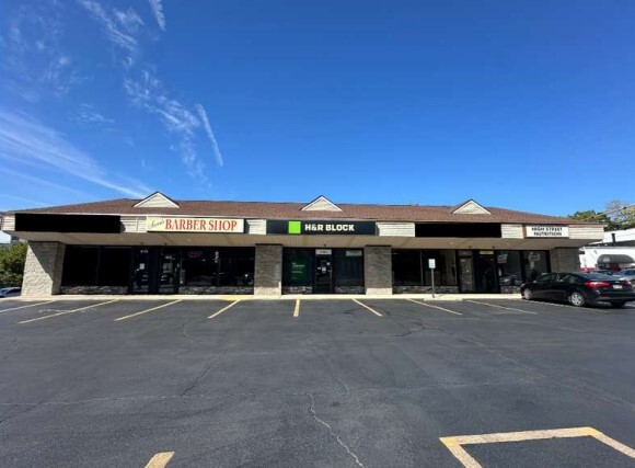
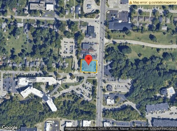
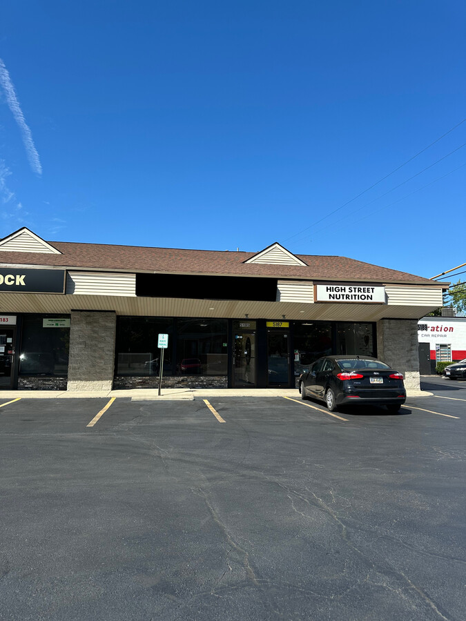
Property Record
5179 N High St, Columbus, OH 43214
NEARBY LISTINGS FOR SALE OR LEASE
Property Detail
5179 N High St
Columbus
Northwold
Columbus, OH
HIGH ST NORTHWOLD ADD LOTS 8-10& 10VAC AL
010-110835
Franklin
Storebuilding
Ohio
2023
8-10
2023
0.49 AC
006821
North Central
25,374 SF
DEMOGRAPHICS near 5179 N High St
1 Mile
3 Mile
5 Mile
2024 Total Population
11,925
110,437
349,589
2029 Population
11,917
109,908
349,138
Pop Growth 2024-2029
(0.07%)
(0.48%)
(0.13%)
Average Age
43
40
37
2024 Total Households
6,002
48,681
143,151
HH Growth 2024-2029
+ 0.03%
(0.44%)
(0.11%)
Median Household Inc
$69,740
$71,542
$64,689
Avg Household Size
1.90
2.20
2.30
2024 Avg HH Vehicles
2.00
2.00
2.00
Median Home Value
$287,864
$294,167
$273,762
Median Year Built
1957
1966
1972
Nearby Places
- Restaurants
- Banks
- Shops
- Fitness
- Groceries
PUBLIC TRANSPORTATION
AIRPORT
John Glenn Columbus International
DRIVE
WALK
Distance
John Glenn Columbus International
20 min
13.3 mi
Rickenbacker International
DRIVE
WALK
Distance
Rickenbacker International
33 min
22.4 mi
Freight Ports
Port of Toledo
DRIVE
WALK
Distance
Port of Toledo
174 min
136.3 mi
SALE & LEASE HISTORY
LISTING DATE
SALE/LEASE

Sep 19, 2024
For Lease
Oct 03, 2017
For Lease
Jan 31, 2019
For Lease
Nearby Properties
Address
Land Use
TOTAL SIZE
Lot Size
Zoning
Address
Land Use
TOTAL SIZE
Lot Size
Zoning
3,462,019 SF
54.42 AC
Address
Land Use
TOTAL SIZE
Lot Size
Zoning
182,845 SF
325.61 AC
Address
Land Use
TOTAL SIZE
Lot Size
Zoning
548,535 SF
325.61 AC
Address
Land Use
TOTAL SIZE
Lot Size
Zoning
720,432 SF
45.78 AC
Address
Land Use
TOTAL SIZE
Lot Size
Zoning
133,425 SF
20.51 AC
Address
Land Use
TOTAL SIZE
Lot Size
Zoning
383,533 SF
84.68 AC
Address
Land Use
TOTAL SIZE
Lot Size
Zoning
1,034,007 SF
8.45 AC
Address
Land Use
TOTAL SIZE
Lot Size
Zoning
967,995 SF
11.72 AC
Address
Land Use
TOTAL SIZE
Lot Size
Zoning
703,512 SF
5.40 AC
Address
Land Use
TOTAL SIZE
Lot Size
Zoning
561,921 SF
6.81 AC
Address
Land Use
TOTAL SIZE
Lot Size
Zoning
1,070,310 SF
2.65 AC
Address
Land Use
TOTAL SIZE
Lot Size
Zoning
286,169 SF
11.08 AC
Address
Land Use
TOTAL SIZE
Lot Size
Zoning
820,734 SF
0.94 AC
Address
Land Use
TOTAL SIZE
Lot Size
Zoning
425,872 SF
10.05 AC
Address
Land Use
TOTAL SIZE
Lot Size
Zoning
733,806 SF
27.30 AC
Address
Land Use
TOTAL SIZE
Lot Size
Zoning
148.89 AC
Address
Land Use
TOTAL SIZE
Lot Size
Zoning
273,112 SF
13.97 AC
Address
Land Use
TOTAL SIZE
Lot Size
Zoning
167,550 SF
36.79 AC
Address
Land Use
TOTAL SIZE
Lot Size
Zoning
260,802 SF
8.80 AC
Address
Land Use
TOTAL SIZE
Lot Size
Zoning
170,237 SF
97.38 AC
Address
Land Use
TOTAL SIZE
Lot Size
Zoning
1,074,792 SF
10.88 AC
Address
Land Use
TOTAL SIZE
Lot Size
Zoning
157,919 SF
13.18 AC
Address
Land Use
TOTAL SIZE
Lot Size
Zoning
451,404 SF
24.57 AC
Address
Land Use
TOTAL SIZE
Lot Size
Zoning
111,168 SF
19.43 AC
Address
Land Use
TOTAL SIZE
Lot Size
Zoning
138,100 SF
8.38 AC
Address
Land Use
TOTAL SIZE
Lot Size
Zoning
131,040 SF
2.50 AC
Address
Land Use
TOTAL SIZE
Lot Size
Zoning
352,730 SF
17.94 AC
Address
Land Use
TOTAL SIZE
Lot Size
Zoning
561,675 SF
10.28 AC
Address
Land Use
TOTAL SIZE
Lot Size
Zoning
436,158 SF
16.24 AC
Address
Land Use
TOTAL SIZE
Lot Size
Zoning
728,361 SF
21.12 AC
The World's #1 Commercial Real Estate Marketplace
Connect with us
© 2025 CoStar Group
The information above has been obtained from sources believed reliable. While we do not doubt its accuracy we have not verified it and make no guarantee, warranty or representation about it. It is your responsibility to independently confirm its accuracy and completeness. Any projections, opinions, assumptions, or estimates used are for example only and do not represent the current or future performance of the property. The value of this transaction to you depends on tax and other factors which should be evaluated by your tax, financial, and legal advisors. You and your advisors should conduct a careful, independent investigation of the property to determine to your satisfaction the suitability of the property for your needs.