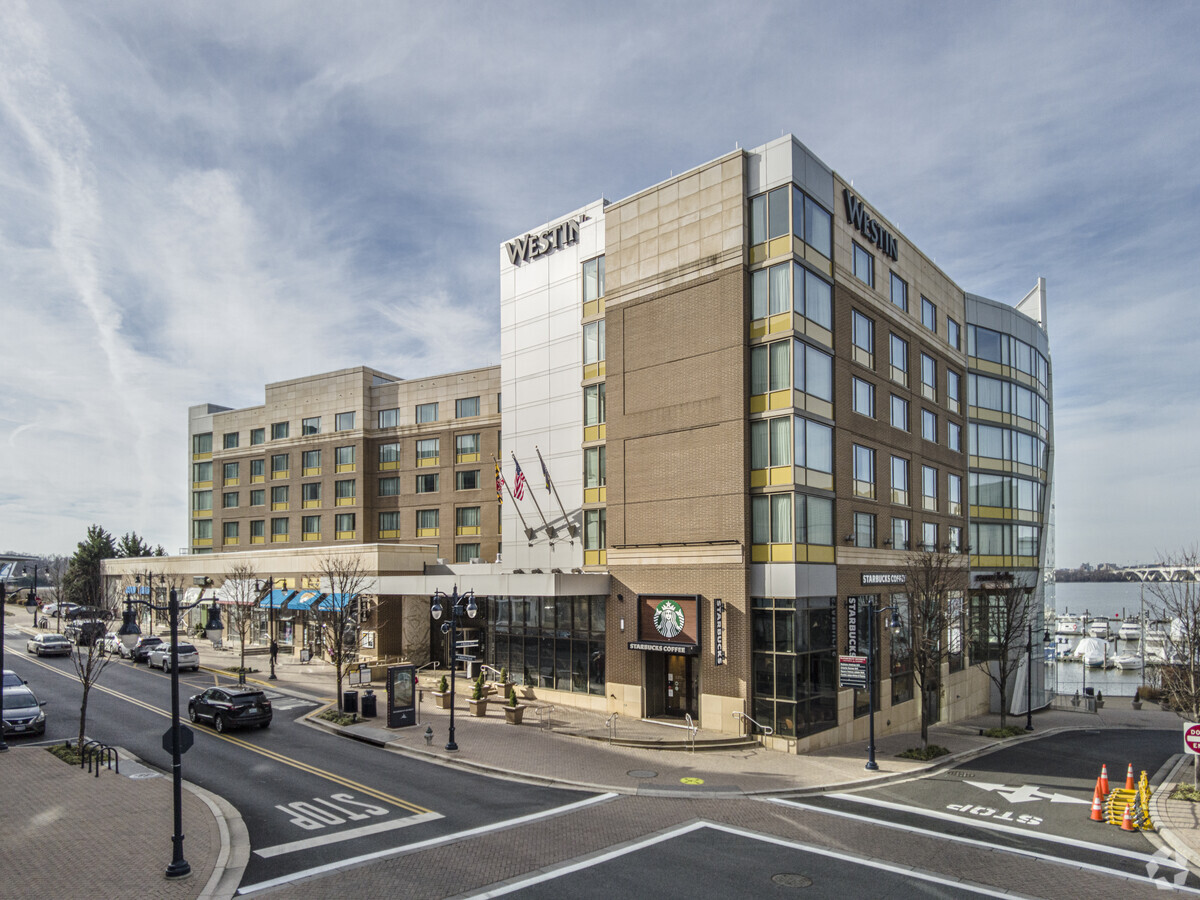
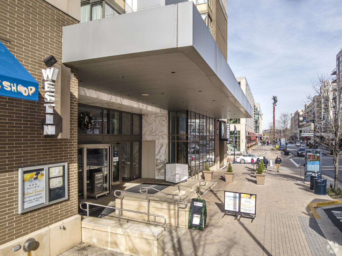
Property Record
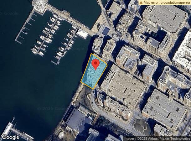
Waterfront St, Oxon Hill, MD 20745
NEARBY LISTINGS FOR SALE OR LEASE
Property Detail
Waterfront St
Washington-Arlington-Alexandria, DC-VA-MD-WV
Plat Six National Harbor
12-3755782
PARCEL 4
Hotel
Prince George's
AE
Maryland
5155190045F
4
2024
1.07 AC
2024
Maryland South/East
801707
Washington, DC
165,240 SF
DEMOGRAPHICS near Waterfront St
1 Mile
3 Mile
5 Mile
2024 Total Population
6,738
91,787
301,061
2029 Population
6,630
89,567
291,614
Pop Growth 2024-2029
(1.60%)
(2.42%)
(3.14%)
Average Age
44
42
40
2024 Total Households
2,806
42,118
122,882
HH Growth 2024-2029
(1.60%)
(2.35%)
(3.20%)
Median Household Inc
$118,861
$103,664
$99,143
Avg Household Size
2.40
2.10
2.40
2024 Avg HH Vehicles
2.00
1.00
2.00
Median Home Value
$455,374
$477,871
$504,020
Median Year Built
1990
1975
1972
Nearby Places
- Restaurants
- Banks
- Shops
- Fitness
- Groceries
PUBLIC TRANSPORTATION
COMMUTER RAIL
Alexandria (Fredericksburg Line - Virginia Railway Express, Manassas Line - Virginia Railway Express)
DRIVE
WALK
Distance
Alexandria (Fredericksburg Line - Virginia Railway Express, Manassas Line - Virginia Railway Express)
10 min
5.5 mi
Crystal City (Fredericksburg Line - Virginia Railway Express, Manassas Line - Virginia Railway Express)
DRIVE
WALK
Distance
Crystal City (Fredericksburg Line - Virginia Railway Express, Manassas Line - Virginia Railway Express)
19 min
7.9 mi
AIRPORT
Ronald Reagan Washington Ntl
DRIVE
WALK
Distance
Ronald Reagan Washington Ntl
20 min
8.2 mi
Washington Dulles International
DRIVE
WALK
Distance
Washington Dulles International
55 min
36.1 mi
Freight Ports
Port of Baltimore
DRIVE
WALK
Distance
Port of Baltimore
67 min
44.1 mi
Nearby Properties
Address
Land Use
TOTAL SIZE
Lot Size
Zoning
Address
Land Use
TOTAL SIZE
Lot Size
Zoning
1,241,298 SF
11.53 AC
RTOLE
Address
Land Use
TOTAL SIZE
Lot Size
Zoning
2,308,874 SF
22.78 AC
RR
Address
Land Use
TOTAL SIZE
Lot Size
Zoning
5,419 SF
39.48 AC
UNZONED,PD
Address
Land Use
TOTAL SIZE
Lot Size
Zoning
1,931,127 SF
11.53 AC
RTOLE
Address
Land Use
TOTAL SIZE
Lot Size
Zoning
336,904 SF
2.12 AC
CDD#15
Address
Land Use
TOTAL SIZE
Lot Size
Zoning
1,278,930 SF
28.17 AC
PRM
Address
Land Use
TOTAL SIZE
Lot Size
Zoning
360,007 SF
35.80 AC
UT
Address
Land Use
TOTAL SIZE
Lot Size
Zoning
1,178,900 SF
4.67 AC
CDD#1
Address
Land Use
TOTAL SIZE
Lot Size
Zoning
559,357 SF
2.26 AC
CDD#2
Address
Land Use
TOTAL SIZE
Lot Size
Zoning
445,727 SF
12.82 AC
RC
Address
Land Use
TOTAL SIZE
Lot Size
Zoning
166,800 SF
2.72 AC
CDD#1
Address
Land Use
TOTAL SIZE
Lot Size
Zoning
203,000 SF
1.55 AC
OCH
Address
Land Use
TOTAL SIZE
Lot Size
Zoning
288,675 SF
2 AC
RM
Address
Land Use
TOTAL SIZE
Lot Size
Zoning
360,524 SF
2.59 AC
CRMU/H
Address
Land Use
TOTAL SIZE
Lot Size
Zoning
2,070,264 SF
84 AC
UNZONED
Address
Land Use
TOTAL SIZE
Lot Size
Zoning
358,188 SF
2.44 AC
CDD#1
Address
Land Use
TOTAL SIZE
Lot Size
Zoning
1.43 AC
CDD#1
Address
Land Use
TOTAL SIZE
Lot Size
Zoning
373,996 SF
40.89 AC
IE
Address
Land Use
TOTAL SIZE
Lot Size
Zoning
270,335 SF
1.46 AC
CDD#2
Address
Land Use
TOTAL SIZE
Lot Size
Zoning
7.72 AC
OCM(100)
Address
Land Use
TOTAL SIZE
Lot Size
Zoning
454,720 SF
11.52 AC
RC
Address
Land Use
TOTAL SIZE
Lot Size
Zoning
258,963 SF
1 AC
CRMU/H
Address
Land Use
TOTAL SIZE
Lot Size
Zoning
293,944 SF
1.85 AC
CDD#11
Address
Land Use
TOTAL SIZE
Lot Size
Zoning
404,775 SF
1.31 AC
CDD#1
Address
Land Use
TOTAL SIZE
Lot Size
Zoning
447,751 SF
1.32 AC
CDD#1
Address
Land Use
TOTAL SIZE
Lot Size
Zoning
1.14 AC
CDD#1
Address
Land Use
TOTAL SIZE
Lot Size
Zoning
263,018 SF
0.66 AC
CDD#15
Address
Land Use
TOTAL SIZE
Lot Size
Zoning
352,103 SF
10.17 AC
R-30
Address
Land Use
TOTAL SIZE
Lot Size
Zoning
374,097 SF
36.22 AC
NAC
Address
Land Use
TOTAL SIZE
Lot Size
Zoning
234,226 SF
8.86 AC
OCM(100)
The World's #1 Commercial Real Estate Marketplace
Connect with us
© 2025 CoStar Group
The information above has been obtained from sources believed reliable. While we do not doubt its accuracy we have not verified it and make no guarantee, warranty or representation about it. It is your responsibility to independently confirm its accuracy and completeness. Any projections, opinions, assumptions, or estimates used are for example only and do not represent the current or future performance of the property. The value of this transaction to you depends on tax and other factors which should be evaluated by your tax, financial, and legal advisors. You and your advisors should conduct a careful, independent investigation of the property to determine to your satisfaction the suitability of the property for your needs.