Property Record
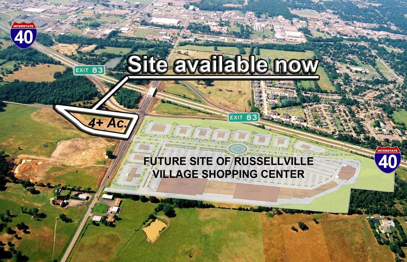
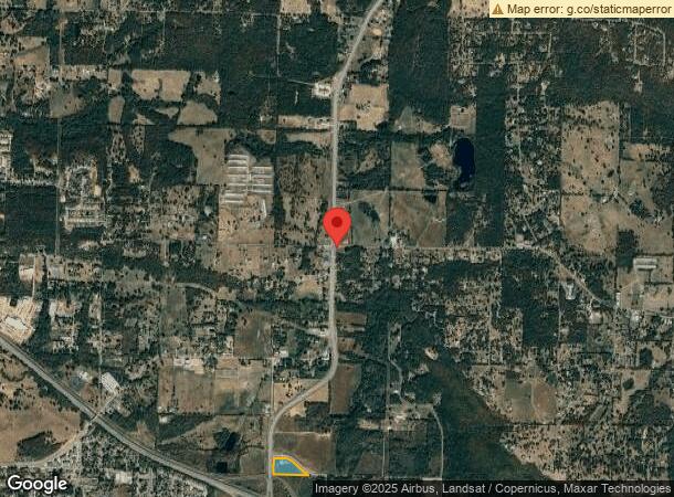
Weir Rd, Russellville, AR 72802
NEARBY LISTINGS FOR SALE OR LEASE
Property Detail
Weir Rd
048-01620-003C
PT SE SE
Commercialacreage
Pope
X
Arkansas
05115C0390E
4.38 AC
2024
Fort Smith/Russellville I-40
2024
Other Market Areas
951201
Russellville, AR
DEMOGRAPHICS near Weir Rd
1 Mile
3 Mile
5 Mile
2024 Total Population
3,450
24,980
37,440
2029 Population
3,518
25,515
38,293
Pop Growth 2024-2029
+ 1.97%
+ 2.14%
+ 2.28%
Average Age
34
36
37
2024 Total Households
1,442
9,654
14,258
HH Growth 2024-2029
+ 2.08%
+ 2.23%
+ 2.36%
Median Household Inc
$35,385
$41,156
$45,652
Avg Household Size
2.20
2.40
2.40
2024 Avg HH Vehicles
2.00
2.00
2.00
Median Home Value
$95,434
$148,145
$165,212
Median Year Built
1979
1982
1984
Nearby Places
- Restaurants
- Banks
- Shops
- Fitness
- Groceries
SALE & LEASE HISTORY
LISTING DATE
SALE/LEASE

Nov 04, 2016
For Sale
Nearby Properties
Address
Land Use
TOTAL SIZE
Lot Size
Zoning
Address
Land Use
TOTAL SIZE
Lot Size
Zoning
95,305 SF
17.27 AC
Address
Land Use
TOTAL SIZE
Lot Size
Zoning
807,059 SF
53.70 AC
Address
Land Use
TOTAL SIZE
Lot Size
Zoning
189,756 SF
18.30 AC
Address
Land Use
TOTAL SIZE
Lot Size
Zoning
61,652 SF
20 AC
Address
Land Use
TOTAL SIZE
Lot Size
Zoning
221,457 SF
22.28 AC
Address
Land Use
TOTAL SIZE
Lot Size
Zoning
277,687 SF
28.83 AC
Address
Land Use
TOTAL SIZE
Lot Size
Zoning
68,660 SF
17.63 AC
Address
Land Use
TOTAL SIZE
Lot Size
Zoning
4,550 SF
7.26 AC
Address
Land Use
TOTAL SIZE
Lot Size
Zoning
2,001 SF
7.80 AC
Address
Land Use
TOTAL SIZE
Lot Size
Zoning
109,751 SF
15.40 AC
Address
Land Use
TOTAL SIZE
Lot Size
Zoning
18,448 SF
1.66 AC
Address
Land Use
TOTAL SIZE
Lot Size
Zoning
113,308 SF
18.02 AC
Address
Land Use
TOTAL SIZE
Lot Size
Zoning
12,078 SF
22.32 AC
Address
Land Use
TOTAL SIZE
Lot Size
Zoning
327,436 SF
29 AC
Address
Land Use
TOTAL SIZE
Lot Size
Zoning
65,141 SF
2.35 AC
Address
Land Use
TOTAL SIZE
Lot Size
Zoning
133,229 SF
40 AC
Address
Land Use
TOTAL SIZE
Lot Size
Zoning
226,225 SF
27.89 AC
Address
Land Use
TOTAL SIZE
Lot Size
Zoning
42,183 SF
6.92 AC
Address
Land Use
TOTAL SIZE
Lot Size
Zoning
195,016 SF
12.91 AC
Address
Land Use
TOTAL SIZE
Lot Size
Zoning
64,974 SF
7.33 AC
Address
Land Use
TOTAL SIZE
Lot Size
Zoning
12,315 SF
7.50 AC
Address
Land Use
TOTAL SIZE
Lot Size
Zoning
58,103 SF
4.62 AC
Address
Land Use
TOTAL SIZE
Lot Size
Zoning
126,294 SF
9.10 AC
Address
Land Use
TOTAL SIZE
Lot Size
Zoning
287,866 SF
39 AC
Address
Land Use
TOTAL SIZE
Lot Size
Zoning
15,482 SF
11.49 AC
Address
Land Use
TOTAL SIZE
Lot Size
Zoning
59,719 SF
6.25 AC
Address
Land Use
TOTAL SIZE
Lot Size
Zoning
41,245 SF
1.62 AC
Address
Land Use
TOTAL SIZE
Lot Size
Zoning
40,937 SF
5.07 AC
Address
Land Use
TOTAL SIZE
Lot Size
Zoning
50,615 SF
2.04 AC
Address
Land Use
TOTAL SIZE
Lot Size
Zoning
148,588 SF
16.38 AC
The World's #1 Commercial Real Estate Marketplace
Connect with us
© 2025 CoStar Group
The information above has been obtained from sources believed reliable. While we do not doubt its accuracy we have not verified it and make no guarantee, warranty or representation about it. It is your responsibility to independently confirm its accuracy and completeness. Any projections, opinions, assumptions, or estimates used are for example only and do not represent the current or future performance of the property. The value of this transaction to you depends on tax and other factors which should be evaluated by your tax, financial, and legal advisors. You and your advisors should conduct a careful, independent investigation of the property to determine to your satisfaction the suitability of the property for your needs.