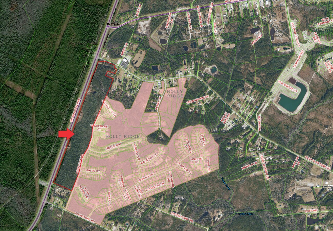
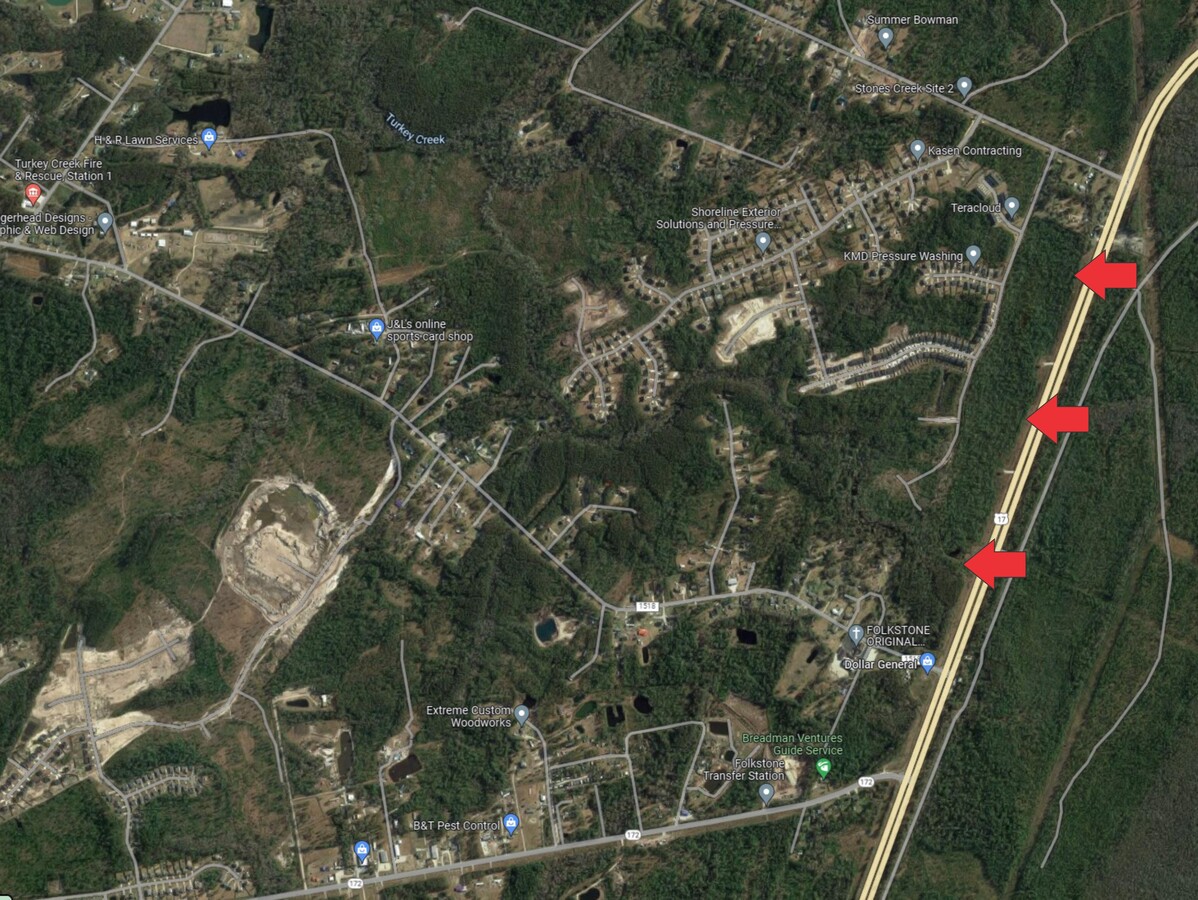
Property Record
Wilmington Hwy, Holly Ridge, NC 28445
This Property Is For Sale
NEARBY LISTINGS FOR SALE OR LEASE
-
-
View all Holly Ridge listings for sale on LoopNet.com
Property Detail
Wilmington Hwy
025285
US 17 & SR 1518
Vacantlandnec
Onslow
X
North Carolina
3720424800J
59.22 AC
2024
Coastal Carolina
2024
Other Market Areas
920105
Jacksonville, NC
DEMOGRAPHICS near Wilmington Hwy
1 Mile
3 Mile
5 Mile
2024 Total Population
2,204
6,172
18,084
2029 Population
2,362
7,100
21,382
Pop Growth 2024-2029
+ 7.17%
+ 15.04%
+ 18.24%
Average Age
35
38
40
2024 Total Households
841
2,413
7,310
HH Growth 2024-2029
+ 7.61%
+ 15.58%
+ 18.70%
Median Household Inc
$65,503
$65,404
$73,038
Avg Household Size
2.50
2.50
2.40
2024 Avg HH Vehicles
2.00
2.00
2.00
Median Home Value
$235,540
$232,380
$283,333
Median Year Built
2006
2002
2003
Nearby Places
- Restaurants
- Banks
- Shops
- Fitness
- Groceries
PUBLIC TRANSPORTATION
AIRPORT
Wilmington International
DRIVE
WALK
Distance
Wilmington International
49 min
32.2 mi
Albert J Ellis
DRIVE
WALK
Distance
Albert J Ellis
58 min
36.4 mi
Freight Ports
Port of Wilmington
DRIVE
WALK
Distance
Port of Wilmington
56 min
34.1 mi
Nearby Properties
Address
Land Use
TOTAL SIZE
Lot Size
Zoning
Address
Land Use
TOTAL SIZE
Lot Size
Zoning
196,268 SF
87.61 AC
RP
Address
Land Use
TOTAL SIZE
Lot Size
Zoning
47,280 SF
20 AC
Address
Land Use
TOTAL SIZE
Lot Size
Zoning
42,092 SF
6.23 AC
SEEMAP
Address
Land Use
TOTAL SIZE
Lot Size
Zoning
1,213.25 AC
R-15
Address
Land Use
TOTAL SIZE
Lot Size
Zoning
27,948 SF
3.13 AC
B2
Address
Land Use
TOTAL SIZE
Lot Size
Zoning
36,000 SF
4.64 AC
B2RA
Address
Land Use
TOTAL SIZE
Lot Size
Zoning
46,080 SF
7.41 AC
Address
Land Use
TOTAL SIZE
Lot Size
Zoning
4.02 AC
R5
Address
Land Use
TOTAL SIZE
Lot Size
Zoning
146.90 AC
SEEMAP
Address
Land Use
TOTAL SIZE
Lot Size
Zoning
250.77 AC
HB
Address
Land Use
TOTAL SIZE
Lot Size
Zoning
8,644 SF
10.22 AC
C1
Address
Land Use
TOTAL SIZE
Lot Size
Zoning
5,481 SF
31.91 AC
R-10A
Address
Land Use
TOTAL SIZE
Lot Size
Zoning
34,996 SF
5.86 AC
SEEMAP
Address
Land Use
TOTAL SIZE
Lot Size
Zoning
900 SF
4.74 AC
C1
Address
Land Use
TOTAL SIZE
Lot Size
Zoning
4,700 SF
13 AC
FA
Address
Land Use
TOTAL SIZE
Lot Size
Zoning
13,606 SF
1.52 AC
SEEMAP
Address
Land Use
TOTAL SIZE
Lot Size
Zoning
1,481.92 AC
CON
Address
Land Use
TOTAL SIZE
Lot Size
Zoning
15,360 SF
0.95 AC
C2
Address
Land Use
TOTAL SIZE
Lot Size
Zoning
2,035 SF
0.21 AC
Address
Land Use
TOTAL SIZE
Lot Size
Zoning
8,990 SF
1.10 AC
C1
Address
Land Use
TOTAL SIZE
Lot Size
Zoning
1,420 SF
23.59 AC
PD
Address
Land Use
TOTAL SIZE
Lot Size
Zoning
2,760 SF
3.99 AC
SEEMAP
Address
Land Use
TOTAL SIZE
Lot Size
Zoning
7,141 SF
6.39 AC
LI
Address
Land Use
TOTAL SIZE
Lot Size
Zoning
8,408 SF
16.40 AC
R-15
Address
Land Use
TOTAL SIZE
Lot Size
Zoning
9,949 SF
1.14 AC
C2
Address
Land Use
TOTAL SIZE
Lot Size
Zoning
9,237 SF
2.17 AC
SEEMAP
Address
Land Use
TOTAL SIZE
Lot Size
Zoning
552.42 AC
RA
Address
Land Use
TOTAL SIZE
Lot Size
Zoning
2.10 AC
INCORP
Address
Land Use
TOTAL SIZE
Lot Size
Zoning
11,205 SF
1.31 AC
HB
Address
Land Use
TOTAL SIZE
Lot Size
Zoning
0.10 AC
B1
The World's #1 Commercial Real Estate Marketplace
Connect with us
© 2025 CoStar Group
The information above has been obtained from sources believed reliable. While we do not doubt its accuracy we have not verified it and make no guarantee, warranty or representation about it. It is your responsibility to independently confirm its accuracy and completeness. Any projections, opinions, assumptions, or estimates used are for example only and do not represent the current or future performance of the property. The value of this transaction to you depends on tax and other factors which should be evaluated by your tax, financial, and legal advisors. You and your advisors should conduct a careful, independent investigation of the property to determine to your satisfaction the suitability of the property for your needs.